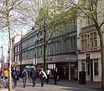
Friar Street, Reading
Shopping streets in Reading, BerkshireTourist attractions in Reading, Berkshire

Friar Street is a thoroughfare in the English town of Reading. It runs parallel to Broad Street, connected by Union Street, Queen Victoria Street and Cross Street. At the western end is the Greyfriars Church and at the eastern end are the Town Hall and St Laurence's Church.
Excerpt from the Wikipedia article Friar Street, Reading (License: CC BY-SA 3.0, Authors, Images).Friar Street, Reading
Friar Street, Reading Coley
Geographical coordinates (GPS) Address Nearby Places Show on map
Geographical coordinates (GPS)
| Latitude | Longitude |
|---|---|
| N 51.456652777778 ° | E -0.97361944444444 ° |
Address
CeX
Friar Street
RG1 1EX Reading, Coley
England, United Kingdom
Open on Google Maps


