place

Warner (CDP), New Hampshire

Census-designated places in Merrimack County, New HampshireCensus-designated places in New HampshireUse mdy dates from July 2023
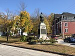
Warner NH Town Hall Oct 2020

Warner is a census-designated place (CDP) and the main village in the town of Warner in Merrimack County, New Hampshire, United States. The population of the CDP was 453 at the 2020 census, out of 2,937 in the entire town.

Excerpt from the Wikipedia article Warner (CDP), New Hampshire (License: CC BY-SA 3.0, Authors, Images).

Warner (CDP), New Hampshire
East Main Street,

Geographical coordinates (GPS) Address Website Nearby Places
placeShow on map

Wikipedia: Warner (CDP), New HampshireContinue reading on Wikipedia

Geographical coordinates (GPS)

Latitude Longitude
N 43.280555555556 ° E -71.816388888889 °
placeShow on map

Address

The Local

East Main Street 2
03278
New Hampshire, United States
mapOpen on Google Maps

Website
thelocalwarner.com

linkVisit website

Warner NH Town Hall Oct 2020
Share experience

Nearby Places

Dalton Covered Bridge

The Dalton Covered Bridge, also called the Dalton Bridge, is a historic covered bridge that carries Joppa Road over the Warner River in Warner, New Hampshire. Its name refers to a nearby resident (first "Mrs. Dalton", then "Widow Dalton") at the time of its construction. The bridge was built in 1853 by Joshua Sanborn, and its original abutments were built by George Sawyer and Webster Davis; all were local residents. The bridge has a span of 76 feet (23 m), with a total bridge length (including portals and roof) of 84 feet (26 m). The bridge is 17 feet (5.2 m) wide, with a road bed width of 14 feet (4.3 m), although guard rails have reduced its usable width to just under 13 feet (4.0 m).The bridge uses a combination of truss types to support the load, following a patent issued in 1837 to Stephen Long, who also patented the Long truss. Its primary support mechanism is a king post truss, in which a vertical post is joined to chord members by iron bolts. This primary support is supplemented by a queen post truss system that flank the king truss walls. The trusses are mounted on abutments that are primarily fieldstone, but were capped in concrete in the 20th century. The mounting is secured by iron tension rods. The exterior walls of the bridge are vertical boarding with four windows; this finish was also rehabilitated in the 1960s. The gabled roof is made of corrugated metal.The bridge was listed on the National Register of Historic Places in 1976.

Waterloo Historic District (Warner, New Hampshire)

The Waterloo Historic District encompasses the site of one of the first mills on the Warner River, near the Waterloo Falls in Warner, New Hampshire. The 50-acre (20 ha) district includes most of the original 60-acre (24 ha) land grant for the mill site. It extends along Waterloo Street and Newmarket Street for a length of about 1 mile (1.6 km), from where Newmarket Street crosses the Warner River to where Waterloo Street crosses a brook. In addition to its industrial history, the district is notable for being home to two nationally known politicians: William E. Chandler (1835-1917), who served as United States Senator and as United States Secretary of the Navy, and Nehemiah G. Ordway (1828-1907), the seventh governor of the Dakota Territory.This part of Warner was first sold off for development in the 1770s, and the first sawmill was operating by 1789. The oldest surviving house in the district, a 1+1⁄2-story Cape style house, was built in 1791, and a significant number of houses in the district were built before 1820. William Chandler's house, purchased by him in 1872, was built in 1805, and he purchased a nearby 1820s house for staff he needed for entertaining high-profile guests. Nehemiah Ordway's house, at the corner of Newmarket and Waterloo, was built in 1828, but was restyled in the early 20th century to give it a Colonial Revival appearance.Several non-residential buildings have survived, although most have been repurposed into residences. The Bean Tavern is a Georgian structure built in 1793. Two structures that served as train stations survive, one built in 1849, which was moved a short distance to make way for the second, built in 1910. The principal surviving industrial building is the 1836 Chandler Mill, whose surviving 2+1⁄2-story portion stands off Newmarket Street between the railroad tracks and the river. Remnants of earlier mill foundations lie nearby. The district also includes a cemetery (1815), and a c. 1810 one-room schoolhouse.The district was listed on the National Register of Historic Places in 2003. It also includes the Waterloo Covered Bridge, a separately-listed bridge which carries Newmarket Street over the river.