place

Castlefield

Areas of ManchesterEngvarB from October 2017Tourist attractions in ManchesterVague or ambiguous time from July 2010
Uk manchester castlefield

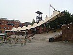
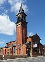
Castlefield is an inner-city conservation area in Manchester, North West England. The conservation area which bears its name is bounded by the River Irwell, Quay Street, Deansgate and Chester Road. It was the site of the Roman era fort of Mamucium or Mancunium which gave its name to Manchester. It was the terminus of the Bridgewater Canal, the world's first industrial canal, built in 1764; the oldest canal warehouse opened in 1779. The world's first passenger railway terminated here in 1830, at Liverpool Road railway station and the first railway warehouse opened here in 1831. The Rochdale Canal met the Bridgewater Canal at Castlefield in 1805 and in the 1830s they were linked with the Mersey and Irwell Navigation by two short cuts. In 1848 the two viaducts of the Manchester, South Junction and Altrincham Railway crossed the area and joined each other, two further viaducts and one mainline station Manchester Central railway station followed. It has a tram station, Deansgate-Castlefield tram stop (formerly G-Mex) providing frequent Manchester Metrolink services to Eccles, Bury, Altrincham, Manchester Piccadilly, East Didsbury and Rochdale. Castlefield was designated a conservation area in 1980 and the United Kingdom's first designated urban heritage park in 1982.

Excerpt from the Wikipedia article Castlefield (License: CC BY-SA 3.0, Authors, Images).

Castlefield
Rice Street, Manchester City Centre

Geographical coordinates (GPS) Address Nearby Places
placeShow on map

Wikipedia: CastlefieldContinue reading on Wikipedia

Geographical coordinates (GPS)

Latitude Longitude
N 53.475 ° E -2.255 °
placeShow on map

Address

Mamucium

Rice Street
M3 4JL Manchester, City Centre
England, United Kingdom
mapOpen on Google Maps

Uk manchester castlefield
Share experience

Nearby Places

Deansgate Square
Deansgate Square

Deansgate Square, formerly known as Owen Street, is a skyscraper cluster on the southern edge of Manchester City Centre, consisting of four towers, the tallest of which is 201 metres (659 ft). The site is just south of Deansgate railway station and north of the Mancunian Way, bounded by Deansgate, Owen Street and the River Medlock. The towers sit at different angles to each other, with a slight bevel, or 'cut back', on each side of each building which ensures the towers catch the light at different times of day.Manchester City Council adopted a framework in the early 2000s, known as the Great Jackson Street Development Framework, which earmarked the site as an acceptable location for high-rise buildings. The framework was enacted to encourage building development, as the site had been vacant for many years and was perceived to be isolated as it was bounded by major arterial roads.In 2016, the scheme was revived with a planning application for a cluster of four skyscrapers – the tallest being the South Tower at 201 m (659 ft). The South Tower surpassed the 169 m (554 ft) Beetham Tower as the tallest building in Greater Manchester in November 2018. Construction on the tower complex officially began in July 2016, with developer Renaker beginning construction on the South Tower and West Tower, the latter being 141 m (463 ft) tall. In October 2017, construction commenced on the North and East Towers, which are 122 m (400 ft) and 158 m (518 ft) tall respectively. Overall completion of the development occurred in late 2020. As of February 2023, additional towers are under construction in the adjacent vicinity as part of the Great Jackson Street Development Framework, including the 152 m (499 ft) Elizabeth Tower which was completed in 2021.