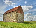
Dengie Peninsula

Dengie (pronounced with a soft 'g') is a peninsula in Essex, England, that once formed a hundred of the same name (sometimes spelled Dengy). The peninsula is formed by the River Crouch to the south, the Blackwater to the north, both of which are tidal, and the North Sea to the east. The eastern part of the peninsula is marshy and forms the Dengie Marshes. The western boundary of Dengie hundred ran from North Fambridge to a bit west of Maldon. The peninsula forms about half of the Maldon local government district. Places on the peninsula are: Althorne Asheldham Bradwell-on-Sea Bradwell Waterside Burnham-on-Crouch Cold Norton Creeksea Dengie (village) Hazeleigh Langford Latchingdon Maldon Mayland Maylandsea Mundon North Fambridge Ostend Purleigh Ramsey Island Snoreham Southminster Steeple Stow Maries St Lawrence Bay Tillingham Woodham Mortimer Woodham Walter
Excerpt from the Wikipedia article Dengie Peninsula (License: CC BY-SA 3.0, Authors, Images).Dengie Peninsula
East End Road, Essex
Geographical coordinates (GPS) Address Nearby Places Show on map
Geographical coordinates (GPS)
| Latitude | Longitude |
|---|---|
| N 51.733333333333 ° | E 0.93333333333333 ° |
Address
East End Road
CM0 7PN Essex, Bradwell-on-Sea
England, United Kingdom
Open on Google Maps


