place

Dyckman-Hillside Substation

1905 establishments in New York CityBeaux-Arts architecture in New York CityBuildings and structures on the National Register of Historic Places in ManhattanEnergy infrastructure completed in 1905Industrial buildings and structures in Manhattan
Industrial buildings and structures on the National Register of Historic Places in New York CityInwood, ManhattanManhattan Registered Historic Place stubsManhattan building and structure stubsNew York City Subway infrastructureUse mdy dates from February 2019
Dyckman Hillsde Substation from Hillside Avenue

The Dyckman-Hillside Substation, also known as Substation 17, is a historic electrical substation located at 127-129 Hillside Avenue between Sickles Street and Nagle Avenue, near the Dyckman Street station of the New York City Subway's IRT Broadway–Seventh Avenue Line, in Inwood, Manhattan, New York City. It was one of eight substations constructed by the Interborough Rapid Transit Company in 1904–05. The substation is a two-story, freestanding masonry building in the Beaux-Arts style. It features a hipped roof, tower-like projections, scrolled wrought iron brackets, and terra cotta decorative details.It was listed on the National Register of Historic Places in 2006.

Excerpt from the Wikipedia article Dyckman-Hillside Substation (License: CC BY-SA 3.0, Authors, Images).

Dyckman-Hillside Substation
Sickles Street, New York Manhattan

Geographical coordinates (GPS) Address Nearby Places
placeShow on map

Wikipedia: Dyckman-Hillside SubstationContinue reading on Wikipedia

Geographical coordinates (GPS)

Latitude Longitude
N 40.86 ° E -73.926944444444 °
placeShow on map

Address

Sickles Street 1
10040 New York, Manhattan
New York, United States
mapOpen on Google Maps

Dyckman Hillsde Substation from Hillside Avenue
Share experience

Nearby Places

George Washington Educational Campus

The George Washington Educational Campus is a facility of the New York City Department of Education located at 549 Audubon Avenue at West 193rd Street in the Fort George neighborhood of Washington Heights, Manhattan, New York City, United States. Within the building are located four schools: The first floor is the High School for Media and Communications (M463). The second floor houses The College Academy, formerly the High School for International Business and Finance (M462). The third floor houses the High School for Health Careers and Sciences (M468). The fourth floor houses the High School for Law and Public Service (M467).The building is located on the site of the former Fort George Amusement Park.: 30  The school opened on February 2, 1917, as an annex of Morris High School. George Washington High School was founded in 1919, and moved into the building in 1925. It was known by that name until 1999, when the building was divided into the four small schools. George Washington Education Campus has a Works Progress Administration (WPA) mural, The Evolution of Music, painted by Lucienne Bloch in 1938. This mural was painted in a room originally used as a music room and later as a dance studio. The campus also houses one of only two NJROTC units in New York City, in its basement, led by Commander Edward Gunning (Ret.) and Chief Petty Officer John Sikora (Ret.). New York-Presbyterian Hospital maintains a clinic on the first floor.

191st Street station

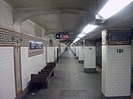
The 191st Street station is a station on the IRT Broadway–Seventh Avenue Line of the New York City Subway. Located at the intersection of St. Nicholas Avenue and 191st Street in the Washington Heights section of Manhattan, it is served by the 1 train at all times. It is the deepest station in the New York City Subway system at about 173 feet (53 m) below street level. Access to the station's main entrance is only provided by four elevators from the mezzanine situated above the platforms. A 1,000-foot-long (300 m) pedestrian tunnel also extends west from the station to Broadway, connecting it with the Fort George neighborhood. Built by the Interborough Rapid Transit Company (IRT), the station opened on January 14, 1911, as an infill station along the first subway. Even though the line through the area had opened five years earlier, no station was constructed at this location because the surrounding neighborhood had a lower population than other areas of Manhattan. Before the opening of the pedestrian tunnel two years later, the area's hilly topography made it hard for area residents to access the station. The opening of the station and the tunnel led to the development of the surrounding area, including the construction of apartment buildings. Hundreds of lots held by the Bennett family since 1835 were sold at an auction in 1919. These provided additional housing opportunities for the middle class, taking advantage of the area's improved transportation access.

Fort Tryon Park
Fort Tryon Park

Fort Tryon Park is a public park located in the Hudson Heights and Inwood neighborhoods of the borough of Manhattan in New York City. The 67-acre (27 ha) park is situated on a ridge in Upper Manhattan, close to the Hudson River to the west. It extends mostly from 192nd Street in the south to Riverside Drive in the north, and from Broadway in the east to the Henry Hudson Parkway in the west. The main entrance to the park is at Margaret Corbin Circle, at the intersection of Fort Washington Avenue and Cabrini Boulevard. The area was known by the local Lenape tribe as Chquaesgeck and by Dutch settlers as Lange Bergh (Long Hill). During the American Revolutionary War, the Battle of Fort Washington was fought at the site of the park on November 16, 1776. The area remained sparsely populated during the 19th century, but by the turn of the 20th century, it was the location of large country estates. Beginning in January 1917, philanthropist John D. Rockefeller, Jr., bought up the "Tryon Hall" estate of Chicago industrialist C. K. G. Billings and several others to create Fort Tryon Park. He engaged the Olmsted Brothers firm to design the park and hired James W. Dawson to create the planting plan. Rockefeller gave the land to the city in 1931, after two prior attempts to do so were unsuccessful, and the park was completed in 1935. Rockefeller also bought sculptor George Gray Barnard's collection of medieval art and gave it to the Metropolitan Museum of Art, which from 1935 to 1939 built the Cloisters in Fort Tryon Park to house the collection. The park is built on a high formation of Manhattan schist with igneous intrusions and glacial striations from the last ice age. The park's design included extensive plantings of various flora in the park's many gardens, including the Heather Garden, which was restored in the 1980s. Besides the gardens and the Cloisters, the park has extensive walking paths and meadows, with views of the Hudson and Harlem Rivers. Fort Tryon Park was added to the National Register of Historic Places on December 19, 1978 and was designated a New York City Scenic Landmark in 1983.

Fort George (New York)

Fort George was the name of five forts in what is now the state of New York.The first Fort George was built in 1626 in the Dutch colony of New Amsterdam and named Fort Amsterdam. The British Army renamed it Fort James in 1664. It was briefly reoccupied by the Dutch from 1673 to 1674 as Fort Willem Hendrick. The British renamed it Fort William Henry in 1691, Fort Anne or Queen's Fort in 1703, and finally Fort George in 1714. The north side bastions and ramparts were destroyed in the American Revolutionary War in 1776 by the Americans and finally demolished in 1790. The site is now the location of the Alexander Hamilton U.S. Custom House in Lower Manhattan. A second Fort George was built by the British in 1755 at Oswego, New York, but it was destroyed by the French commander Louis-Joseph de Montcalm in 1756. The site is now Montcalm Park, bordered by West Schulyer Street, Montcalm Street and West 6th Street.A third Fort George was built in Lake George, New York, in 1755. It was destroyed in 1777 and abandoned in 1780. It was located southeast of Fort William Henry facing Lake George, in the wooded area within Lake George Battlefield Park.A fourth Fort George was an encampment built on Staten Island around 1777 in the area of St. George, Staten Island, likely Fort Hill.The last Fort George was built in 1776 in New York City on Fort George Hill, near the current intersection of Audubon Avenue and West 192nd Street in Upper Manhattan. Briefly named Fort Clinton and finally Fort George, from 1895 to 1914 it was the site of the Fort George Amusement Park and is now the location of George Washington Educational Campus and part of Highbridge Park. Fort George Hill is also the name of a present-day street in the area. The neighborhood surrounding the hill is called Fort George and is considered a subneighborhood of Washington Heights. It is generally agreed to run from West 181st Street to Dyckman Street east of Broadway to the Harlem River.