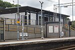
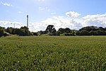
Aldham, Essex

Aldham is a village and civil parish in the City of Colchester district of Essex, England. It is located 4+1⁄2 mi (7.2 km) west of Colchester. The village is in the parliamentary constituency of Harwich and North Essex. The village has its own parish council.The ancient parish covered 1,847 acres (747 ha) but local-government boundary changes reduced this to 1,770 acres (720 ha) by the mid-twentieth century. The village borders Fordstreet, Marks Tey and the River Colne to the north. The parish is geographically on an incline, with the land sloping from around 170 feet (50 m) in the northwest down to around 60 feet (20 m) near the Roman River, where it is susceptible to flooding.The 2001 census gave the parish population as 513, decreasing to 491 at the 2011 census. It is 1+2⁄3 miles (2.7 km) from the A12 road, a major trunk road.
Excerpt from the Wikipedia article Aldham, Essex (License: CC BY-SA 3.0, Authors, Images).Aldham, Essex
Brook Road, Colchester Aldham
Geographical coordinates (GPS) Address Nearby Places Show on map
Geographical coordinates (GPS)
| Latitude | Longitude |
|---|---|
| N 51.8933 ° | E 0.7853 ° |
Address
Brook Road
Brook Road
CO6 3RP Colchester, Aldham
England, United Kingdom
Open on Google Maps


