place

Chäserrugg

Appenzell AlpsMountains of SwitzerlandMountains of the AlpsMountains of the canton of St. Gallen
Chäserrugg Hinterrugg

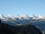
Chäserrugg (or Käserrugg) is a mountain in Wildhaus-Alt St. Johann municipality, Toggenburg, canton of St. Gallen, Switzerland, rising to 2,262 m. It is the easternmost of the "seven peaks" of the Churfirsten, the other six being, running east to west, Hinterrugg (2,306 m), Schibenstoll (2,234 m), Zuestoll (2,235 m), Brisi (2,279 m), Frümsel (2,263 m), Selun (2,205 m). In spite of its being counted among the "seven peaks", it has a modest prominence of just 14 m, forming part of the ridge ascending to Hinterrugg. Part of Toggenburg's ski resort, it is reached from Unterwasser (911 m) by Iltiosbahn, a funicular opened 1934 to Iltios (1,339 m), and from there by aerial lift (opened 1972). The mountain's name translates to "cheesemaker's ridge" and is properly the name of the ridge ascending towards it from the north, beginning at Ruggschöpf at about 1,800 m and was only transferred to the "peak" when the "seven Churfirsten" were systematized in the late 19th or early 20th century; in the 19th century, there was also a fashion of etymologizing the name of the Churfirsten range as Kurfürsten "prince-electors", which occasionally inspired a name variant Kaiserruck "emperor's back" for Chäserrugg.

Excerpt from the Wikipedia article Chäserrugg (License: CC BY-SA 3.0, Authors, Images).

Chäserrugg
Schnüerliweg, Wildhaus-Alt St. Johann

Geographical coordinates (GPS) Address Nearby Places
placeShow on map

Wikipedia: ChäserruggContinue reading on Wikipedia

Geographical coordinates (GPS)

Latitude Longitude
N 47.155 ° E 9.3127777777778 °
placeShow on map

Address

Schnüerliweg
8881 Wildhaus-Alt St. Johann
St. Gallen, Switzerland
mapOpen on Google Maps

Chäserrugg Hinterrugg
Share experience

Nearby Places

Churfirsten
Churfirsten

Churfürsten is a mountain range in the Canton of St. Gallen, Switzerland. They form the natural boundary between the canton's Toggenburg and Sarganserland districts. They are the southernmost range of the Appenzell Alps, separated from the Glarus Alps by the Seez river and Walensee. They consist of a limestone ridge running east to west, with the individual peaks formed by erosion. The ridge is defined much more sharply to the south than to the north, with an almost vertical drop of several hundred meters towards Walenstadtberg and eventually Lake Walensee at 419 m. The southern slope of the range was significantly formed by the Rhine Glacier during the Würm glaciation. The name is a plural, indicating the peaks forming the historical boundary of the bishopric of Chur. It has historically also been folk-etymologized as Kurfürsten, i.e. the 7 prince-electors of the Holy Roman Empire who in the later medieval period (until 1648) numbered seven, which in turn encouraged the count of seven main or "official" peaks.The standard "seven peaks" of the Churfürsten are (from west to east): Selun (2205 m) Frümsel (2263 m) Brisi (2279 m) Zuestoll (2235 m) Schibenstoll (2234 m) Hinterrugg (2306 m) Chäserrugg (2262 m)The count of exactly seven peaks is contrived; sometimes, Chäserrugg is not included and counted as part of Hinterrugg, because of its topographical prominence of a mere 14 m. The Churfürsten seven peaks listed above have remarkably uniform heights (within just above a 100 m difference); the ridge continues both to the east and the west with a number of further peaks between 2000 and 2200 m that are not usually included as Churfürsten: Peaks to the west of Selun: Wart (2068 m), Schären (or Schäären, 2184 m), Nägeliberg (2153 m), Glattchamm (2084 m), Leistchamm (2101 m). Peaks to the east of Chäserrugg: Tristenkolben (2159 m), Gamserrugg (2076 m).