Hazel River
Rappahannock County, Virginia geography stubsRivers of Culpeper County, VirginiaRivers of Rappahannock County, VirginiaRivers of VirginiaTributaries of the Rappahannock River ... and 1 more
Virginia river stubs

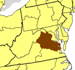
The Hazel River is a 47.8-mile-long (76.9 km) tributary of the Rappahannock River in northern Virginia in the United States. Via the Rappahannock, it is part of the Chesapeake Bay watershed. It rises in Shenandoah National Park and flows generally eastwardly through Rappahannock and Culpeper counties. It joins the Rappahannock River from the west about 3 miles (5 km) northwest of Remington. The Hazel's largest tributaries are the Hughes River, which joins it at the border of Rappahannock and Culpeper counties, and the Thornton River, which joins it in Culpeper County.
Excerpt from the Wikipedia article Hazel River (License: CC BY-SA 3.0, Authors, Images).Hazel River
State Route 659,
Geographical coordinates (GPS) Address Nearby Places Show on map
Geographical coordinates (GPS)
| Latitude | Longitude |
|---|---|
| N 38.55135 ° | E -77.84803 ° |
Address
State Route 659
State Route 659
22734
Virginia, United States
Open on Google Maps


