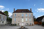
Nogent-le-Rotrou
Communes of Eure-et-LoirPages with French IPAPercheSubprefectures in France

Nogent-le-Rotrou (French: [nɔʒɑ̃ lə ʁɔtʁu]) is a commune in the Eure-et-Loir department in northern France. It is a sub-prefecture and is located on the river Huisne, 56 kilometres west of Chartres on the RN23 and 150 kilometres south west of Paris, to which it is linked by both rail and motorway. It was the former capital of the Perche with the count living in the impressive medieval Château Saint-Jean which still dominates the town from a plateau of the same name.
Excerpt from the Wikipedia article Nogent-le-Rotrou (License: CC BY-SA 3.0, Authors, Images).Nogent-le-Rotrou
Ruelle des Champs, Nogent-le-Rotrou
Geographical coordinates (GPS) Address Nearby Places Show on map
Geographical coordinates (GPS)
| Latitude | Longitude |
|---|---|
| N 48.3225 ° | E 0.8225 ° |
Address
Ruelle des Champs
Ruelle des Champs
28400 Nogent-le-Rotrou
Centre-Val de Loire, France
Open on Google Maps


