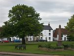
Chalgrave

Chalgrave is a civil parish in the Central Bedfordshire district of Bedfordshire, England. The hamlets of Tebworth and Wingfield are in the west of the parish, with the church and manor in the east. Nearby places are Toddington (to the north), Chalton (to the east), Houghton Regis (to the south), and Hockliffe (to the west). Before 1929, the parish also included part of the village of Hockliffe.Chalgrave is part of the ward of 'Heath and Reach' which sends a Councillor to Central Bedfordshire Council. The ward includes the villages of Heath and Reach, Hockliffe, Eggington, Stanbridge, Tilsworth, Tebworth, and Wingrave. The ward was created in 2011 and has since been represented by Councillor Mark Versallion.
Excerpt from the Wikipedia article Chalgrave (License: CC BY-SA 3.0, Authors, Images).Chalgrave
Lords Hill,
Geographical coordinates (GPS) Address Nearby Places Show on map
Geographical coordinates (GPS)
| Latitude | Longitude |
|---|---|
| N 51.9267 ° | E -0.5348 ° |
Address
Lords Hill
Lords Hill
LU5 6JL , Chalgrave
England, United Kingdom
Open on Google Maps


