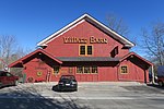
Chepachet, Rhode Island
Census-designated places in Providence County, Rhode IslandCensus-designated places in Rhode IslandGlocester, Rhode IslandHistoric districts in Providence County, Rhode IslandHistoric districts on the National Register of Historic Places in Rhode Island ... and 6 more
NRHP infobox with nocatNational Register of Historic Places in Providence County, Rhode IslandProvidence metropolitan areaUse mdy dates from July 2023Villages in Providence County, Rhode IslandVillages in Rhode Island

Chepachet is a village and census-designated place (CDP) in the town of Glocester in the northwestern part of the U.S. state of Rhode Island. It is centered at the intersection of U.S. Route 44 (a.k.a. Putnam Pike) and Rhode Island Route 102 (also known as Victory Highway and Chopmist Hill Road). Chepachet's ZIP code is 02814. As of the 2010 census, the CDP had a population of 1,675.
Excerpt from the Wikipedia article Chepachet, Rhode Island (License: CC BY-SA 3.0, Authors, Images).Chepachet, Rhode Island
Putnam Pike,
Geographical coordinates (GPS) Address Nearby Places Show on map
Geographical coordinates (GPS)
| Latitude | Longitude |
|---|---|
| N 41.915 ° | E -71.671388888889 ° |
Address
Putnam Pike
Putnam Pike
02814
Rhode Island, United States
Open on Google Maps


