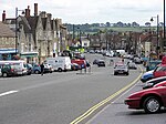
Dodington, Gloucestershire
Dodington is a village and civil parish in South Gloucestershire, England. The village lies in a small, fertile valley between Codrington and Old Sodbury, and runs together with the even tinier hamlet of Coombes End. It is about 2.5 miles southeast of Chipping Sodbury and four miles from Yate railway station. The River Frome rises within Dodington Park, the estate that originally formed the economic basis of this small village. The Cotswold Way also passes through the north end of the village. The River Boyd rises just south of the village. In addition to the rural area around the village, the parish nowadays encompasses substantial housing areas to the south of Yate and Chipping Sodbury, the latter being the location of Dodington Parish Hall.
Excerpt from the Wikipedia article Dodington, Gloucestershire (License: CC BY-SA 3.0, Authors).Dodington, Gloucestershire
Dodington Lane,
Geographical coordinates (GPS) Address Nearby Places Show on map
Geographical coordinates (GPS)
| Latitude | Longitude |
|---|---|
| N 51.5186 ° | E -2.36225 ° |
Address
Dodington Lane
Dodington Lane
BS37 6SD , Sodbury
England, United Kingdom
Open on Google Maps


