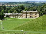
Tormarton

Tormarton is a village in South Gloucestershire, England. Its name may come from Thor Maer Tun meaning The settlement with the thorn (tree) on the boundary. Another source suggests the name derives from the church tower (Tor) on the border between Wessex and Mercia (Anglo-Saxon Meark). It is one mile North-East of junction 18 of the M4 motorway, with the A46 road and close to the border between Wiltshire and South Gloucestershire. In 2001 and 2011 there were 144 households and the population was 348. A National Trail, the Cotswold Way passes through the village. There is a church, a hotel, a pub and also a number of bed and breakfasts in the village. A Highways Agency depot with a salt dome is situated near to the village.
Excerpt from the Wikipedia article Tormarton (License: CC BY-SA 3.0, Authors, Images).Tormarton
Geographical coordinates (GPS) Address Nearby Places Show on map
Geographical coordinates (GPS)
| Latitude | Longitude |
|---|---|
| N 51.507 ° | E -2.335 ° |
Address
GL9 1HZ
England, United Kingdom
Open on Google Maps


