Totland
Civil parishes in the Isle of WightIsle of Wight geography stubsUse British English from August 2023Villages on the Isle of Wight

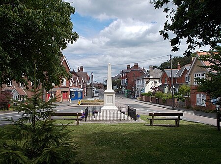
Totland is a village, civil parish and electoral ward on the Isle of Wight. Besides the village of Totland, the civil parish comprises the western tip of the Isle of Wight, and includes The Needles, Tennyson Down and the hamlet of Middleton. The village of Totland lies on the Western peninsula where the Western Yar almost cuts through along with Alum Bay and Freshwater. It lies on the coast at Colwell Bay, which is the closest part of the island to the British mainland.
Excerpt from the Wikipedia article Totland (License: CC BY-SA 3.0, Authors, Images).Totland
Colwell Common Road,
Geographical coordinates (GPS) Address Nearby Places Show on map
Geographical coordinates (GPS)
| Latitude | Longitude |
|---|---|
| N 50.68492 ° | E -1.53658 ° |
Address
Colwell Common Road
PO39 0BY , Middleton
England, United Kingdom
Open on Google Maps


