place

Fairlawn Centre

Canadian shopping mall stubsOttawa stubsShopping malls established in 1961Shopping malls in OttawaStrip malls
Fairlawn Plaza Ottawa

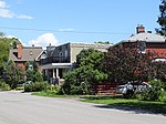
The Fairlawn Centre (formerly Fairlawn Plaza) is a strip mall along Carling Avenue in Ottawa, Ontario, Canada. The mall opened in 1961 when the plaza's original tenants were Steinberg's grocery store and J. Pascal Hardware. Miracle Mart was also one of the early tenants.Canadian Tire was a tenant from December 1974 until it closed in March 2008 and moved to a bigger location 2 kilometres east on Carling Avenue. The Royal Bank of Canada also had a branch at the plaza. Fairlawn Diner, a dry cleaners, and a beauty salon and barbers shop which all closed during renovations in 2009–10. Business had been severely affected when Canadian Tire closed. The expansion of Carlingwood Mall directly across Carling Avenue, which itself had many of the same types of retail stores as Fairlawn Plaza, may be one reason for the mall's dwindling customer base. The site was partially redeveloped in the early 2010s. The expanded Fairlawn Centre now includes Harvey's, Swiss Chalet, H&R Block and Bridgehead Coffee.

Excerpt from the Wikipedia article Fairlawn Centre (License: CC BY-SA 3.0, Authors, Images).

Fairlawn Centre
Carling Avenue, (Old) Ottawa

Geographical coordinates (GPS) Address Phone number Website Nearby Places
placeShow on map

Wikipedia: Fairlawn CentreContinue reading on Wikipedia

Geographical coordinates (GPS)

Latitude Longitude
N 45.36962 ° E -75.769 °
placeShow on map

Address

Staples

Carling Avenue 2148
K2A 1H1 (Old) Ottawa
Ontario, Canada
mapOpen on Google Maps

Phone number

call+16137294585

Website
staples.ca

linkVisit website

Fairlawn Plaza Ottawa
Share experience

Nearby Places

Carlingwood
Carlingwood

Carlingwood is a neighbourhood in Bay Ward in the west end of Ottawa, Ontario, Canada. The neighbourhood is roughly bounded on the north by Richmond Road, on the east by Sherbourne Road, on the south by Carling Avenue and on the west by Woodroffe Avenue. This area corresponds to census tract 5050032.01, which had a population of 3,558 according to the Canada 2016 Census.The Carlingwood Shopping Centre was built in 1956 at the corner of Carling and Woodroffe. The surrounding neighbourhood would be built later in the decade. Somserset Towers and the Saville Apartments (then known as Saville Terrace) were built in the early 1960s, and Bromley Square was built in the early 1970s. Carlingwood is home to two parks, Westwood and Woodroffe, the latter of which has a playsructure, wading pool, and temporary hockey rink (in winter). Byron Linear Tramway Park is located nearby. It is also home of Woodroffe Avenue Public School, Our Lady of Fatima School and the Ottawa Public Library Carlingwood Branch. Churches in Carlingwood include Our Lady of Fatima Catholic, Ukrainian Orthodox Cathedral Assumption Of The Blessed Virgin, Woodroffe United, St. Martin's Anglican, and Bromley Road Baptist. During the summer, Shouldice Berry Farms operates a stand at the corner of Byron and Woodroffe. Carlingwood is also the home to the soon-to-come Sherbourne station in the Ottawa Confederation Line West Extension, to come in 2025.OC Transpo routes 51, 11, 85, and 87 pass through it or on a nearby major road.

Whitehaven, Ottawa

Whitehaven (also spelled White Haven) is a neighbourhood located in Bay Ward in the west end of Ottawa, Ontario, Canada, about 10 kilometres west of downtown. It is bounded by Carling Avenue to the north, Woodroffe Avenue to the east, the OC Transpo Transitway to the west and highway 417 to the south. The population of the neighbourhood is about 2350 (2011 Census) Whitehaven was developed on the lands of Fox farm starting in the 1950s. The Fox farm homestead can still be found on Fox Crescent in the north part of the neighbourhood with its windmill tower now shaded by a large tree. Originally the east side of the neighbourhood was subdivided into large lots, typically 50 by 50 metres. In the 1960s, the west side was developed with smaller lots but mostly large custom homes. At the same time, many lots in the east side of the neighbourhood were subdivided and infill housing was built. Subdivisions have continued through to today, giving Whitehaven a very eclectic housing character. Whitehaven Crescent was built up throughout the mid 1960s as the area's namesake. The south west side of the neighbourhood contains a large park with a playground, with schools including D. Roy Kennedy Public School and Woodroffe High School. In the 1960s there was also a public primary school which operated until 1999 called Whitehaven Public School. It was closed for a few years after much dispute and then was reopened and expanded as a French primary school, called Terre des Jeunes. Whitehaven has plenty of transportation links, green space and shopping centres. The Carlingwood and Lincoln Fields shopping malls are within walking distance of the neighbourhood. Both shopping centres are serviced extensively by OC Transpo with Lincoln Fields being serviced by the Lincoln Fields Transit Station on the Transitway Whitehaven is also connected locally to a network of bike paths with direct access to downtown Ottawa.