place

High Beach

Use British English from February 2015Villages in EssexWaltham Abbey
Epping Forest Centenary Walk 1 Sept 2008

High Beach (or High Beech) is a village inside Epping Forest in south-west Essex, England. Part of the civil parish of Waltham Abbey, the village is within the Epping Forest District and the ward of Waltham Abbey High Beach, and lies approximately 11 miles (18 km) north-east of Charing Cross. It is the location of Lippitts Hill and the Metropolitan Police Air Support Unit.

Excerpt from the Wikipedia article High Beach (License: CC BY-SA 3.0, Authors, Images).

High Beach
High Beech Loughton, Epping Forest Waltham Abbey

Geographical coordinates (GPS) Address Nearby Places
placeShow on map

Wikipedia: High BeachContinue reading on Wikipedia

Geographical coordinates (GPS)

Latitude Longitude
N 51.662 ° E 0.032 °
placeShow on map

Address

High Beech Loughton

High Beech Loughton
IG10 4BF Epping Forest, Waltham Abbey
England, United Kingdom
mapOpen on Google Maps

Epping Forest Centenary Walk 1 Sept 2008
Share experience

Nearby Places

Turpin's Cave
Turpin's Cave

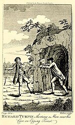
Turpin's Cave is an area of Epping Forest in Essex which has been attributed as a hiding place of the highwayman Dick Turpin. Dick Turpin knew Epping Forest well and organised many criminal activities from a base between the Loughton Road and Kings Oak Road, which in legend became known as 'Turpin's cave'. After an incident in May 1737, Turpin escaped to Epping Forest, where he hid (according to accounts "in a cave"). He was seen by Thomas Morris, a servant of one of the Forest's keepers close to what is now 'The Robin Hood' pub. Morris armed with pistols, attempted to capture Turpin on the 4th of May; Turpin however shot and killed him with a carbine. The murder was reported in The Gentleman's Magazine The terrain in most of Epping Forest comprises Bagshot Beds, which are sand and gravel and not solid enough to provide habitable caves such as the one illustrated. Though several locations for Turpin's hiding place were suggested, legend attributed it to a site off Wellington Hill at High Beach. D'Oyley, the Loughton surveyor, who drew up the maps for the Epping Forest Commission in the 19th century marked the area to the north of Loughton Camp as Dick Turpin's Cave and the name was applied to a pub at that location B H Cowper, who excavated Loughton Camp in the 1870s referred to maps identifying Turpin's cave within the camp, but found no evidence of a cave there. However an identifiable dug-out was visible in the 19th century as in 1883 John Croumbie Brown wrote "Turpin's Cave is as much one of the exhibitions of Epping Forest as Turpin's Oak is of Finchley Common, and who shall begrudge to the admirers of each, in these unromantic and prosaic days, the indulgence of their tastes".The Turpin's Inn pub dates from some time in the 19th century as it was visited by John Davidson in 1893 who complains in his "Random Itinerary" of being made to pay a deposit for the drinking pot there. A housing development has since been built over the pub but next to it was a fenced-off dug-out in the clay and gravel soil described as Turpin's Cave, all or part of which was visible when the photograph was taken in the 1960s. The site in Epping Forest is not the only one with the name Turpin's Cave. There is a "Turpin's Cave" at the edge of Bostall Woods in Plumstead Another site known as Dick Turpin’s Cave is at Rammamere Heath near Heath and Reach, Bedfordshire .

Metropolitan Police Air Support Unit

The Air Support Unit (ASU) was a Central Operations branch of London's Metropolitan Police Service. The main responsibility of the unit was to provide aerial reconnaissance and other air support operations. Helicopters are particularly useful in aiding searches for missing persons, car pursuits, suspect capture and large public order operations such as football matches. The ASU also supported other emergency services, including the London Fire Brigade, London Ambulance Service and Marine Coastguard. On 31 March 2015, the National Police Air Service took over providing air support to the Metropolitan Police Service (along with all other police forces in England and Wales). This resulted in the closure of the Metropolitan Police Air Support Unit. The Metropolitan Police Service has also reportedly been secretly using Cessna aircraft for a number of years that have been fitted with surveillance equipment capable of intercepting mobile phone calls and listening in on conversations.Formed in 1980, the unit was based at Lippitts Hill, Essex and had 48 personnel comprising 3 sergeants, 18 constables, 4 aircraft engineers, 1 avionics engineer, 11 pilots and was headed by an inspector. The unit also employed other members of staff, including operations room staff and an intelligence officer. The senior management were based at Wapping police station. All pilots were ex-military Royal Navy but also Army Air Corps. Each aircraft was crewed by a pilot with two officers acting as observers, and averaged over 260 flying hours per month.In 1980, the ASU started with Bell 222A helicopters and in 1993 transitioned to Eurocopter AS355N Squirrel helicopters.In July 2007, the ASU took delivery of three new Eurocopter EC145s costing a total of £15 million, using the call signs India 97, India 98 and India 99. Each aircraft has an L-3 Wescam MX-15 sensor pod which houses a gyro-stabilised colour "day" camera and a thermal imaging camera with digital video downlink from the helicopter.In February 2015, it was announced that the control of the Metropolitan Police Air Support Unit was to be transferred to the National Police Air Service (NPAS) on 31 March, and that the base at Lippitts Hill would close in the following year. A projected new base at Elstree was intended to serve Hertfordshire, Bedfordshire, and Essex as well as London. However, by February 2017, a replacement for the Lippitts Hill base had not been procured, and the possibility of using RAF Northolt instead was being investigated.On 7 September 2017 it was provisionally agreed by Epping Forest District Council to allow the unit to operate three helicopters and one fixed wing aircraft from North Weald Airfield in Essex, with a 25-year lease.

Loughton Camp
Loughton Camp

Loughton Camp is an Iron Age (~500 BC) Hill fort in Epping Forest, one mile (1.6 km) northwest of the town of Loughton. The camp's earthworks cover an area of approximately 10 acres (4 hectares) and are visible today as a low bank and ditch encircling the main camp. The banks were most probably once a single high rampart, used for defence and the appearance of the ditch suggests it was once very wide and deep in places. The camp lies on one of the highest points in the surrounding area, on a ridge of high ground, likely to have once been strategic. It is speculated that the camp was used by the Trinovantes in defence against the Catuvellauni. Its elevation suggests that the camp was possibly once a lookout post. However, it may have simply been used as fortification for protection of cattle. A stone Iron Age grain millstone (quern) was found close by. More colourfully, local legend has it that Boudica used the camp, and that Ambresbury Banks was the site of her defeat in AD61 however there is no evidence to corroborate this.The southwestern edge of the camp falls away sharply to an area known as Kate's Cellar (a hermit who reputedly once lived in this area of the forest). An early 19th Century map shows Dick Turpin's hideout here (there are a number of locations within Epping Forest's 6,000 acres (24 km2) which claim the same). The camp was 'discovered' by Mr Benjamin Harris Cowper in 1872. The first archaeology carried out was by General Pitt-Rivers in 1881. In 1882 the Essex Field Club further excavated the banks. Roger Nolan, in his Julius Caesar's Invasion of Britain (2018) says there is no doubt that Loughton Camp was the third marching camp used by Caesar in his invasion of 54BC, en route from Kent to the defeat of the British tribes at Wheathampstead (Devil's Dyke). The Loughton site has never been comprehensively excavated; any proof of this might be apparent from such an excavation. A corresponding camp Ambresbury Banks exists closer to the town of Epping. Both are Scheduled Ancient Earthworks and, as such, must only be explored on foot.

Epping Forest
Epping Forest

Epping Forest is a 2,400-hectare (5,900-acre) area of ancient woodland, and other established habitats, which straddles the border between Greater London and Essex. The main body of the forest stretches from Epping in the north, to Chingford on the edge of the London built-up area. South of Chingford the forest narrows, and forms a green corridor that extends deep into East London, as far as Forest Gate; the Forest's position gives rise to its nickname, the Cockney Paradise. It is the largest forest in London.It lies on a ridge between the valleys of the rivers Lea and Roding. It contains areas of woodland, grassland, heath, streams, bogs and ponds, and its elevation and thin gravelly soil (the result of glaciation) historically made it less suitable for agriculture. The Forest was historically managed as a common; the land was held by a number of local landowners who exercised economic rights over aspects such as timber, while local commoners had grazing and other rights. It was designated a royal forest meaning that only the monarch had the right to hunt deer. The extensive urban areas on the Forest's doorstep bring many visitors to the Forest, and cause a strain on the Forest's ecology; however local recreational users of the Forest were crucial in saving the Forest when it was threatened with enclosure and destruction in the late 19th century. The huge public outcry led the City of London Corporation to buy and so save the site in what was the first major success of the environmental movement in Europe - the Corporation still owns the Forest. This environmental milestone came at a cost, as the City of London's early conservators did not understand the human processes that shaped the forest and its ecosystems, and discontinued the practice of pollarding trees while allowing grazing to decline. This changed the character of the Forest and has led to reduced biodiversity. The modern Conservators are mindful of these historic errors but it is probably not possible to reverse the effects of this long interruption of historic management methods.The Forest gives its name to the Epping Forest local government district, which covers part of it, and to Forest School, a private school in Walthamstow towards the south of it.