place

Dickinson High School (Texas)

Educational institutions in the United States with year of establishment missingGalveston Bay AreaGreater HoustonHigh schools in Galveston County, TexasPublic high schools in Texas
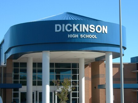
DickinsonHighSchool Texas Entrance

Dickinson High School is located in Dickinson, Texas, United States, in the Dickinson Independent School District. The school serves most of Dickinson, all of San Leon, the majority of Bacliff, and portions of League City and Texas City.The school colors are blue and white with red trims. The Dickinson Gators' school mascot is "Big Al" the alligator.

Excerpt from the Wikipedia article Dickinson High School (Texas) (License: CC BY-SA 3.0, Authors, Images).

Dickinson High School (Texas)
Melvin Utley Drive,

Geographical coordinates (GPS) Address Nearby Places
placeShow on map

Wikipedia: Dickinson High School (Texas)Continue reading on Wikipedia

Geographical coordinates (GPS)

Latitude Longitude
N 29.4675 ° E -95.031944444444 °
placeShow on map

Address

Dickinson High School

Melvin Utley Drive
77539
Texas, United States
mapOpen on Google Maps

DickinsonHighSchool Texas Entrance
Share experience

Nearby Places

Dickinson Bayou
Dickinson Bayou

Dickinson Bayou is a bayou in Texas. Dickinson Bayou is located in southeast Texas in the San Jacinto-Brazos Coastal Basin. Dickinson Bayou rises two miles northeast of Alvin in northwestern Galveston County (at 29°29' N, 95°14' W) and flows east for over 20 miles to its mouth on Dickinson Bay and Galveston Bay, just south of San Leon and a mile east of the Southern Pacific Railroad (at 29°28' N, 94°57' W). It traverses flat to rolling prairie surfaced by dark, commonly calcareous clays that support mesquite, grasses, and cacti. In the lower reaches of the bayou the soil changes to sandy and clay loams that support scrub brush, hardwoods, and pines. Residents of Dickinson still take the time and the slight risk to enjoy many of the bayou's activities. Those who do so engage in fishing, canoeing, water skiing, swimming, and sight seeing. Two locations are designated for launching watercraft one location being where highway 3 intersects with the bayou for launching boats and small watercraft. The other location is at Paul Hopkins park on FM517. Kayaks and small shallow water boats can travel deep i to the tributaries. The greatest concentration of tributaries fall within the city limits of Dickinson, Texas. These tributaries pass through many neighborhoods. Major named tributaries that flow to Dickinson Bayou include Gum Bayou, Benson Bayou, Magnolia (Geisler) Bayou, Bordens Gully, Cedar Creek, and LaFlore's Bayou. Many of these tributaries flow over private property as noted on Galveston County CAD maps. Local residents often have backyard access to the bayou as noted in the picture top left. Fishing is a popular activity for those visiting Dickinson Bayou. In dry summers drought the water becomes saltier and produces many smaller saltwater fish not usually seen in brackish water. These include ladyfish, redfish, croaker, piggy perch, and an occasional speckled trout. In the winter months, flounder make an appearance in the section of the bayou closest to the bay. Spring brings out small largemouth bass and catfish in the lower reaches of the bayou. The bayou plays host to the Dickinson Festival of Lights every Christmas at Paul Hopkins Park. This proves perfect as the nearly 1 million lights reflect from the bayou's murky waters. Dickinson Bayou is on the state's list of water bodies not meeting water quality standards for dissolved oxygen (DO) and bacteria levels. As a result, the bayou does not meet its aquatic life use nor its contact recreation use, creating a possible environmental and/or public health concern.
Galveston Bay Area
Galveston Bay Area

The Galveston Bay Area, also known as Bay Area Houston or simply the Bay Area, is a region that surrounds the Galveston Bay estuary of Southeast Texas in the United States, within Houston–The Woodlands–Sugar Land metropolitan area. Normally the term refers to the mainland communities around the bay and excludes Galveston as well as most of Houston. Originally part of the pirate kingdom of Jean Lafitte, this area played a role in the early history of Texas having been the site of some early rebellions against Mexican rule and the site of the victory of the Texas army over the Mexican army during the Texas Revolution. Ranching interests became early economic drivers around the bay. As the nearby cities of Galveston and Houston developed as commercial centers, the Bay Area communities became part of a principal commercial corridor between the cities. The Bay Area is also the location of NASA's Lyndon B. Johnson Space Center which houses the Christopher C. Kraft Jr. Mission Control Center. The City of Houston's official nickname as "Space City" is derived from this. In addition, a large tourist attraction for area visitors is Space Center Houston. The landscape around the bay features a mix of swamps, beaches, industrial facilities, tourist attractions, and historic sites. The area's developing population is ethnically diverse with a growing international community. The communities host cultural events ranging from ballet and musical theater to fairs and rodeos. The bay itself supports a commercial fishing industry and features one of the highest concentrations of marinas in the nation. On land the area holds numerous historic sites such as the San Jacinto Monument, and many parks and nature preserves such as the Armand Bayou Nature Center.

History of the Galveston Bay Area

For a period of over 7000 years, humans have inhabited the Galveston Bay Area in what is now the United States. Through their history the communities in the region have been influenced by the once competing sister cities of Houston and Galveston, but still have their own distinct history. Though never truly a single, unified community, the histories of the Bay Area communities have had many common threads. Prior to European settlement the area around Galveston Bay was settled by the Karankawa and Atakapan tribes, who lived throughout the Gulf coast region. Spanish and French explorers traveled the area for many years gradually establishing trade with the local natives. In the early 19th century the pirate Jean Lafitte created a small, short-lived empire around the bay ruled from his base on Galveston Island before his being ousted by the United States Navy. Following Mexico's independence from Spain, the new nation established long-term settlements, including Anahuac and San Jacinto, around the bay. Early settler revolts against Mexican rule occurred in the region, home to the final Texan Victory over the Mexican army during the Texas Revolution. Following Texas' independence from Mexico and its annexation by the United States, economic growth was centered initially on agriculture and cattle ranching. Commerce grew between Galveston, Harrisburg and Houston in the later 19th century, and created additional economic opportunities as railroads were built through the Bay Area to connect these and other commercial centers. In the early 20th century, the region gave birth to some of the state's earliest oil fields and refineries as the Texas Oil Boom took hold. Refining and manufacturing grew rapidly in the area, particularly around Baytown, Pasadena, and Texas City. The opening of the Port of Texas City, and later Barbours Cut and Bayport, gradually established the region as an important shipping center. As wealth increased in southeast Texas, resorts and other tourist draws developed in the Bay Area. During the 1960s the area became home of the Johnson Space Center, headquarters for the nation's crewed space program, which helped diversify the regional economy and began the development of an aerospace industry, and later other high-tech industries.