Everard Park, South Australia

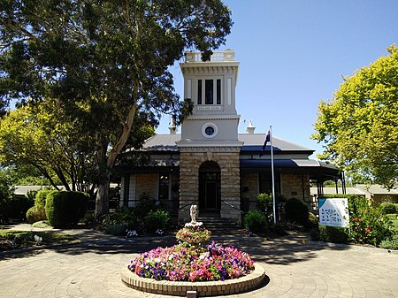
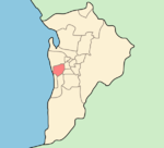
Everard Park is a small inner south-western suburb of Adelaide in the City of Unley, once part of the extensive land holdings of the prominent colonist Dr. Charles George Everard, and the location of "Marshfield", the home of part of his family. It is also the location of Ackland House, built for chaff merchant William Ackland in 1901.The suburb is bounded by Anzac Highway to the northwest, South Road to the west, Norman Terrace and the Glenelg tram line to the southeast, and Third and Fourth Avenues to the east. Surrounding suburbs are Forestville, Ashford, Glandore and Black Forest. The triangular Everard Park Reserve is located in the northern part of the suburb surrounded by Africaine, Nibley and Hillsley Avenues. Aveo Ackland Park retirement village (named after Ackland House) and Lifecare Parkrose Village are located on Norman Terrace. The suburb is served by Glenelg tram stop 5 to the southeast, stop 6 to the south west, and by many bus routes along South Road and Anzac Highway. The art deco Roxy picture theatre building is located on Anzac Highway.
Excerpt from the Wikipedia article Everard Park, South Australia (License: CC BY-SA 3.0, Authors, Images).Everard Park, South Australia
Orchard Avenue, Adelaide Everard Park
Geographical coordinates (GPS) Address Nearby Places Show on map
Geographical coordinates (GPS)
| Latitude | Longitude |
|---|---|
| N -34.954 ° | E 138.575 ° |
Address
Orchard Avenue
Orchard Avenue
5035 Adelaide, Everard Park
South Australia, Australia
Open on Google Maps


