Gills, Caithness
Populated places in Caithness

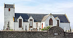
Galltair is a remote coastal, scattered crofting township and former fishing village, on the north coast of Caithness, Scottish Highlands, in the Scottish council area of Highland. The settlement overlooks Gills Bay and consists of Upper Gills to the south and the main township on the coast. The township is between the villages of Mey to the west along the A836 coast road, and the village of Canisbay to the east. A ferry terminal on Gills Bay has a service to Orkney.
Excerpt from the Wikipedia article Gills, Caithness (License: CC BY-SA 3.0, Authors, Images).Gills, Caithness
Geographical coordinates (GPS) Address Nearby Places Show on map
 Continue reading on Wikipedia
 Geographical coordinates (GPS)
| Latitude | Longitude |
|---|---|
| N 58.638 ° | E -3.17 ° |
Address
KW1 4YB
Scotland, United Kingdom
Open on Google Maps