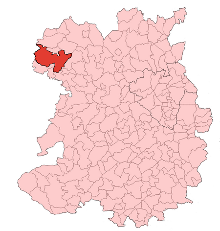
Oswestry Rural
Civil parishes in ShropshireShropshire geography stubsUse British English from March 2020

Oswestry Rural is a geographically large civil parish located in Shropshire, England. It is situated south of Oswestry itself, and extends from the border with Wales in the west. It covers an area of 62 square kilometres (24 sq mi) and had a population of 4,504 in the 2011 censusThe parish includes the villages of Rhydycroesau, Trefonen, Morda, Maesbury, and various other hamlets including Treflach, Whitehaven, Tyn-y-coed, Croesau Bach, Ball and Aston Square.
Excerpt from the Wikipedia article Oswestry Rural (License: CC BY-SA 3.0, Authors, Images).Oswestry Rural
Nant Lane,
Geographical coordinates (GPS) Address Nearby Places Show on map
Geographical coordinates (GPS)
| Latitude | Longitude |
|---|---|
| N 52.8357 ° | E -3.0717 ° |
Address
Nant Lane
Nant Lane
SY10 9AL , Oswestry Rural
England, United Kingdom
Open on Google Maps


