Plessur (river)
Graubünden geography stubsPlessur basinRivers of GraubündenRivers of SwitzerlandSwitzerland river stubs ... and 1 more
Tributaries of the Rhine

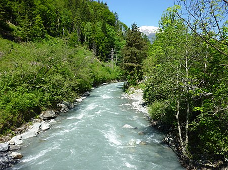
The Plessur is a river, 33 km (21 mi) long, and a right tributary of the Rhine running through the Swiss canton of Graubünden. Its head is near Arosa in the Plessur Range. It then flows through the Schanfigg valley before emptying into the Rhine at Chur. The Langwieser Viaduct, an early reinforced concrete railway bridge constructed in 1914, spans the Plessur near Langwies. Its main tributaries include the Rabiosa, the Welschtobelbach, Sapünerbach and Fondeierbach.
Excerpt from the Wikipedia article Plessur (river) (License: CC BY-SA 3.0, Authors, Images).Plessur (river)
Felsenaustrasse,
Geographical coordinates (GPS) Address Phone number Website Nearby Places Show on map
Geographical coordinates (GPS)
| Latitude | Longitude |
|---|---|
| N 46.862777777778 ° | E 9.5072222222222 ° |
Address
Camp Au
Felsenaustrasse 61
7000 , Industriegebiet
Grisons, Switzerland
Open on Google Maps


