place

Indian Hill Avenue Historic District

Greek Revival architecture in ConnecticutHistoric districts in Middlesex County, ConnecticutHistoric districts on the National Register of Historic Places in ConnecticutNRHP infobox with nocatNational Register of Historic Places in Middlesex County, Connecticut
Portland, ConnecticutVictorian architecture in Connecticut
PortlandCT IndianHillAvenueHD 1

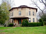
The Indian Hill Avenue Historic District encompasses an 18th-century colonial shipbuilding village, overlaid on a historic and prehistoric Native American settlement, in Portland, Connecticut. Extending along Indian Hill Avenue north of Portland, the district includes a collection of 18th and early 19th-century buildings, and extensive archaeological evidence of Native American occupation (some supported by colonial-era and later documentation). The district was listed on the National Register of Historic Places in 1983.

Excerpt from the Wikipedia article Indian Hill Avenue Historic District (License: CC BY-SA 3.0, Authors, Images).

Indian Hill Avenue Historic District
Indian Hill Avenue,

Geographical coordinates (GPS) Address Nearby Places
placeShow on map

Wikipedia: Indian Hill Avenue Historic DistrictContinue reading on Wikipedia

Geographical coordinates (GPS)

Latitude Longitude
N 41.598333333333 ° E -72.623055555556 °
placeShow on map

Address

Petzold's Marine Center

Indian Hill Avenue
06480
Connecticut, United States
mapOpen on Google Maps

PortlandCT IndianHillAvenueHD 1
Share experience

Nearby Places

Main Street Historic District (Cromwell, Connecticut)

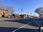
The Main Street Historic District in Cromwell, Connecticut is roughly bounded by Nooks Hill Rd., Prospect Hill Rd., Wall and West Sts. and New Ln., and Stevens Ln. and Main St. It includes two town greens (Valour Green and Memorial Green), historic homes and the Cromwell Historical Society. The historic district is primarily linear and starts from "Patriots Corner" (a grassy area at the corner of Main and Wall Streets with several memorials) and runs north along Main Street (Route 99) past the Memorial Green at Wall Street. Towards the northern end, the district widens to encompass both Main Street and Prospect Hill Road until about Nooks Hill Road, including the Valour Green. The district comprises 66 contributing buildings and structures and has an area of 130 acres (53 ha). The district is notable in capturing the transformation of a rural 18th-century village center into a 20th-century town, with representative architecture from every major architectural style seen between 1750 and 1935. The district was listed on the National Register of Historic Places in 1985.Cromwell was settled in the 17th century, and remained predominantly agricultural in character well into the 19th century. It had a small but locally important port on the Connecticut River, which declined in the 19th century, and Main Street afterward became the principal economic and civic area of the town. Main Street was part of a major turnpike route, connecting Hartford and Old Saybrook, and is where the town's early civic buildings were located.