place

Norman's Woe

Landforms of Essex County, MassachusettsReefs of the United States
'Off Norman's Woe' by Edward Moran, High Museum

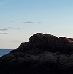
Norman's Woe is a rock reef on Cape Ann in Gloucester, Massachusetts, about 500 feet offshore. It has been the site of a number of ship wrecks including the Rebecca Ann in March, 1823 during a snowstorm. Another was the wreck of the schooner Favorite out of Wiscasset, Maine, in December 1839. It is the subject of an 1872 painting Off Norman's Woe, by Edward Moran.In fiction, it is the site of "The Wreck of the Hesperus", a narrative poem by Henry Wadsworth Longfellow.Its maximum elevation is 23 feet (7.0 meters), but at high tide much of the reef is awash and so is concealed. This may have contributed to the number of wrecks at the site. A bell buoy is placed about 1000 feet ESE of the rock.

Excerpt from the Wikipedia article Norman's Woe (License: CC BY-SA 3.0, Authors, Images).

Norman's Woe
Hesperus Avenue, Gloucester

Geographical coordinates (GPS) Address Nearby Places
placeShow on map

Wikipedia: Norman's WoeContinue reading on Wikipedia

Geographical coordinates (GPS)

Latitude Longitude
N 42.576388888889 ° E -70.699444444444 °
placeShow on map

Address

Hesperus Avenue 130
01930 Gloucester
Massachusetts, United States
mapOpen on Google Maps

'Off Norman's Woe' by Edward Moran, High Museum
Share experience

Nearby Places

Stage Fort Park
Stage Fort Park

Stage Fort Park is a park at Stage Head in Gloucester, Massachusetts, part of the Essex National Heritage Area. It contains two beaches, a large playground, picnic benches, two baseball fields, a basketball court, a dog park and plenty of room for any weekend activities. The park includes Gloucester's Visitor and Welcome Center and Stage Fort, a reconstructed Civil War fort on a site fortified since 1635.A seasonal restaurant in the park, The Cupboard of Gloucester, selling a wide variety of food and ice cream including fried clams and sandwiches. The most prominent geological feature is a large rock, some sixty feet high and two hundred wide. It was said to be an ancient ritual stone used by Native Americans. Stage Head was named for a fishing "stage" dating back to the original settlement by the Dorchester Adventurers Company circa 1624. It was the most likely original site of Roger Conant's "Great House", which was moved to Salem circa 1628. The area was first fortified in 1635 with the Stage Fort and garrisoned intermittently from then until the Spanish–American War. The fort was reconstructed in 1930. The works were also known variously as Fort Gloucester, Eastern Point Fort, Fort Conant, other names, and other variants of these names.An 1862 painting by Fitz Henry Lane, Stage Fort across Gloucester Harbor, depicts the park area and the fort from further north in the harbor. The painting is in the collection of the Metropolitan Museum of Art.

Eastern Point Fort

Eastern Point Fort was a fort that was garrisoned or maintained from 1863 to 1867 on Eastern Point in Gloucester, Massachusetts, built for the American Civil War. References indicate the name has also been used to refer to the much-older Stage Fort across the harbor.In June 1863, Confederate commerce raiders attacked Gloucester-based fishing vessels at Georges Bank, a rich fishing ground east of Cape Cod. Also that year, US Army engineers realized that attacking vessels could be well inside Gloucester's harbor before being engaged by the existing forts, Stage Fort and Fort Defiance. The Eastern Point fort, never formally named, was sited to be able to engage any enemy approaching from seaward. It was built near the end of the peninsula forming the eastern side of Gloucester's harbor, on the "high land of the farm of Thomas Niles". Construction was supervised by Major Charles E. Blunt. Eastern Point was the only Civil War fort on the north shore of Massachusetts Bay not on the site of a previous fortification.The fort was an earthwork that could accommodate seven guns, with three magazines and a bombproof shelter, along with a barracks and hospital outside the fort. However, an armament report dated January 31, 1865 shows ten guns were on hand, including three 32-pounder rifled guns, four 32-pounder smoothbore guns, and three 24-pounder rifled guns. An author has examined a period photograph and determined that the 24-pounders could have been in the bombproof, which was sited for landward defense with embrasures suitable for cannon. Eastern Point was garrisoned by the 2nd and 11th Unattached Companies of Massachusetts militia in 1864. The fort was abandoned in 1867 and the buildings demolished at some point, though the earthworks remain.In the 1920s a resort hotel or manor house named the "Ramparts" was built inside the fort, featuring two stone towers. The main building was razed in 1950, though the towers remain. Today, a private residence exists within the former earthworks of the fort, incorporating one of the towers. During World War II the army built a Fire Control Station nearby the earthworks.