place

Westham Bridge

1911 establishments in Virginia1950 disestablishments in VirginiaBridges completed in 1911Bridges in Richmond, VirginiaBridges over the James River (Virginia)
Buildings and structures in Chesterfield County, VirginiaBuildings and structures in Henrico County, VirginiaFormer toll bridges in VirginiaRoad bridges in Virginia
Westham Bridge View of North Pylon from South Pylon

Westham Bridge crossed the James River between Henrico County and Chesterfield County. The bridge was located between Bosher Dam and Williams Island Dam just west of the 7 miles of rapids and falls which constitute the fall line of the James River at Richmond, Virginia. Built as a toll bridge in 1911, it was named for the nearby Westham Station of the Chesapeake and Ohio Railway near the north end. Also nearby at the north end were the remains of the James River and Kanawha Canal. The privately held company which financed the bridge, Southampton Bridge Corporation, was headed by developer George Craghead Gregory, who also had plans to extend a streetcar line from an existing line at Westhampton Park (now the University of Richmond) to the suburban community of Bon Air. Originally developed as a popular resort, Bon Air had become a bedroom community of Richmond. Between the James River and Bon Air, Gregory controlled large land areas along the proposed rail line which he hoped to develop. However, despite his plans, aside from grading of right-of-way, Gregory's planned streetcar line did not materialize. After 1933, State Route 147 was routed across the Westham Bridge. It connected River Road and Westham Parkway in Henrico with Southampton Road and the new Huguenot Road in Chesterfield. In 1950, the Westham Bridge, which had been subject to flooding and was inadequate for traffic in the growing suburban area, was replaced by the new Huguenot Memorial Bridge, named in honor of the French Huguenot settlers who came to the area in the 18th century to escape religious persecution in France. The old bridge was dismantled, but the abutments for it remained visible at each end, and overhead power and telephone lines continued to mark the route. Traces of the old streetcar right-of-way may be seen along gently sloped Southampton Road and on Hazen Street in Bon Air. Gregory's old mansion, Granite Hall, now surrounded by a subdivision near Williams Island Dam, was still in use as a private residence in 2008. The C&O's Westham Station was relocated to a Richmond city park in 1961.

Excerpt from the Wikipedia article Westham Bridge (License: CC BY-SA 3.0, Authors, Images).

Westham Bridge
Riverside Drive, Richmond

Geographical coordinates (GPS) Address Nearby Places
placeShow on map

Wikipedia: Westham BridgeContinue reading on Wikipedia

Geographical coordinates (GPS)

Latitude Longitude
N 37.561666666667 ° E -77.546722222222 °
placeShow on map

Address

Huguenot Flatwater Boat Ramp

Riverside Drive
23235 Richmond
Virginia, United States
mapOpen on Google Maps

Westham Bridge View of North Pylon from South Pylon
Share experience

Nearby Places

Robins Center
Robins Center

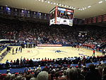
The Robins Center is a 7,201-seat multi-purpose arena in Richmond, Virginia. Opened in 1972, the arena is home to the University of Richmond Spiders basketball. It hosted the ECAC South (now known as the Colonial Athletic Association) men's basketball tournament in 1983. It is named for E. Claiborne Robins Sr, class of 1931, who, along with his family, have been leading benefactors for the school. The opening of the Robins Center returning Spider basketball to an on-campus facility for the first time since the mid-1940s when it outgrew Millhiser Gymnasium. In the intervening decades, the Spiders played home games in numerous locations around the Richmond area, including the Richmond Coliseum (1971–1972), the Richmond Arena (1954–1971), the Benedictine High School gymnasium (1951–1954), Grays' Armory (1950–1951) and Blues' Armory (1947–1950). The Robins Center arena serves as the location of the University of Richmond's commencement exercises and hosted a 1992 Presidential debate involving Bill Clinton, George H. W. Bush, and Ross Perot. The Robins Center saw a number of upgrades in the 2000s, including a new maple floor in 2003 and renovated locker rooms and offices in 2004. A new scoreboard and sound system was installed for the 2006–2007 season. A $17 million renovation started in March 2013, which added four corner video boards, a repainted ceiling and new floor, and the seat capacity decreased from 9,071 to around 7,201 once renovations were completed in January 2014. In 2015, the playing surface was renamed "Dick Tarrant Court" in honor of Dick Tarrant, the school's all-time winningest coach.In addition to the basketball arena, the Robins Center also serves as the home of many of the other athletic programs at the University of Richmond. The Robins Center Natatorium serves as the home of the women's swimming and diving team, while most of the other programs have their coaches' offices in the building. An addition to the Robins Center, known as the Weinstein Center for Fitness and Recreation, opened in January 2007 and provides expanded facilities for recreational use.