place

Oakle Street railway station

1851 establishments in England1964 disestablishments in EnglandBeeching closures in EnglandDisused railway stations in GloucestershireFormer Great Western Railway stations
Pages with no open date in Infobox stationRailway stations in Great Britain closed in 1856Railway stations in Great Britain closed in 1964Railway stations in Great Britain opened in 1851Railway stations in Great Britain opened in 1870South West England railway station stubsUse British English from January 2020
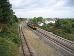
Oakle Street railway station (site), Gloucestershire (geograph 3655571)

Oakle Street railway station served the village of Oakle Street, Gloucestershire, England from 1851 to 1964 on the Gloucester-Newport line.

Excerpt from the Wikipedia article Oakle Street railway station (License: CC BY-SA 3.0, Authors, Images).

Oakle Street railway station
Oakle Street, Forest of Dean Churcham

Geographical coordinates (GPS) Address External links Nearby Places
placeShow on map

Wikipedia: Oakle Street railway stationContinue reading on Wikipedia

Geographical coordinates (GPS)

Latitude Longitude
N 51.8539 ° E -2.3532 °
placeShow on map

Address

Oakle Street

Oakle Street
GL2 8JR Forest of Dean, Churcham
England, United Kingdom
mapOpen on Google Maps

linkWikiData (Q85790119)
linkOpenStreetMap (431514136)

Oakle Street railway station (site), Gloucestershire (geograph 3655571)
Share experience

Nearby Places

Severn bore
Severn bore

The Severn bore is a tidal bore seen on the tidal reaches of the River Severn in south western England. It is formed when the rising tide moves into the funnel-shaped Bristol Channel and Severn Estuary and the surging water forces its way upstream in a series of waves, as far as Gloucester and beyond. The bore behaves differently in different stretches of the river; in the lower, wider parts it is more noticeable in the deep channels as a slight roller, while the water creeps across the sand and mudflats. In the narrower, upper reaches, the river occupies the whole area between its banks and the bore advances in a series of waves that move upstream. Near Gloucester, the advancing water overcomes two weirs, and sometimes one in Tewkesbury, before finally petering out. Bores are present on about 130 days in the year, concentrated on the days immediately following the new and full moon. The size and precise timing of the bore depend on such things as the time of high tide, the barometric pressure, the wind speed and direction, the amount of water coming down the river and how well scoured the main drainage channels are. There are a number of viewpoints from which the bore can be seen, or viewers can walk along the river bank or floodbanks. Historically, the bore has been of importance to shipping visiting the docks at Gloucester, but this was alleviated by the construction of an alternative route, the Gloucester and Sharpness Canal, which opened in 1827. Nowadays the bore is of interest to surfers and canoeists who attempt to ride the waves.

Minsterworth
Minsterworth

Minsterworth is a village in Gloucestershire, England. It lies on the border of the City of Gloucester, on the north bank of the River Severn (effectively on the western side of the river) and on the A48 road between Gloucester and Chepstow. Minsterworth is governed by a parish council. The parish includes the village of Calcott's Green. The population of the village as at the 2011 census was 444. The population in mid-2014 was 470 people, with 70 people aged 0–15, 270 people aged 16–64 and 135 people aged 65+. The higher levels of government are Tewkesbury Borough Council and Gloucestershire County Council. The village has a long history, at one stage being held by the rebellious baron Simon de Montfort. Its economy used to be heavily involved with salmon-fishing in the Severn, as illustrated by a carving in the local church of three salmon caught in a fishing net. Fishing for elvers remains an important activity. The local church, St Peter's, lies right next to the river, with three ancient yews in the churchyard. It was rebuilt by Henry Woodyer (who had earlier worked on the nearby church in Highnam) in 1870, but contains many older features such as a fifteenth-century baptismal font, a Jacobean pulpit and part of a fourteenth-century cope. The village has a church (St Peter's), a primary school (Minsterworth C of E) and a village hall. In December 2017, the primary school was forced to shut down due to a lack of pupils. The Severn Bore Inn, butchers shop and waterski club, often attributed to the village, actually lie outside the parish boundary. It also has a number of listed buildings dating from the 16th, 17th and 18th centuries.The village of Minsterworth is an Acorn Class 2 area and is one of the more desirable areas in Gloucestershire and the most desirable village in close proximity to the city of Gloucester. Average incomes are higher than average for Gloucestershire and England with the total weekly household income for 2007-2008 estimated at £720, compared to £673 for both Gloucestershire and England as a whole. Interest in current affairs is high. The village is one of the best places to view the Severn Bore, where people can be seen surfing and water skiing from the local water ski club. F. W. Harvey, war poet and broadcaster, dubbed the "Laureate of Gloucestershire", is buried in the village churchyard.