Arelerland
Areas of BelgiumArlonGeography of Luxembourg (Belgium)Pages with Dutch IPAPages with French IPA ... and 3 more
Pages with German IPAPages with Luxembourgish IPARegions of Wallonia

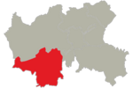
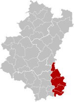
The Land of Arlon (Luxembourgish/German: Arelerland, Luxembourgish pronunciation: [ˈaːʀəlɐlɑnt], German: [ˈaːʁəlɐlant]; French: Pays d'Arlon, French pronunciation: [pe.i daʁlɔ̃]; Dutch: Land van Aarlen [ˌlɑnt fɑn ˈaːrlə(n)]) is the traditionally Luxembourgish-speaking part of Belgian Lorraine, which is now predominantly French-speaking. Arlon is the main city of this region. The area has borders with the Gaume to the west and with the Grand-Duchy of Luxembourg to the east. It lies to the south of the Ardennes. It coincides largely with the arrondissement of Arlon, part of the province of Luxembourg.
Excerpt from the Wikipedia article Arelerland (License: CC BY-SA 3.0, Authors, Images).Arelerland
Rue des Bruyères,
Geographical coordinates (GPS) Address Nearby Places Show on map
Geographical coordinates (GPS)
| Latitude | Longitude |
|---|---|
| N 49.666666666667 ° | E 5.7666666666667 ° |
Address
Rue des Bruyères
6700
Luxembourg, Belgium
Open on Google Maps


