place

Moel Gyw

Clwyd geography stubsMarilyns of WalesMountains and hills of DenbighshirePages with Welsh IPA
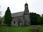
Looking towards Moel Gyw geograph.org.uk 681277

Moel Gyw is a hill in Denbighshire, North Wales and forms part of the Clwydian Range. It is situated just to the south of Moel Famau and Foel Fenlli.

Excerpt from the Wikipedia article Moel Gyw (License: CC BY-SA 3.0, Authors, Images).

Geographical coordinates (GPS)

Latitude Longitude
N 53.10822 ° E -3.23982 °
placeShow on map

Address

Llanbedr Dyffryn Clwyd


, Llanbedr Dyffryn Clwyd
Wales, United Kingdom
mapOpen on Google Maps

Looking towards Moel Gyw geograph.org.uk 681277
Share experience

Nearby Places

Clwydian Range and Dee Valley

The Clwydian Range and Dee Valley (Welsh: Bryniau Clwyd a Dyffryn Dyfrdwy) is a designated Area of Outstanding Natural Beauty (AONB) located in north-east Wales, covering the Clwydian Range (Welsh: Bryniau Clwyd), and the valley of the River Dee (Welsh: Afon Dyfrdwy). Designated in 1985 as the Clwydian Range AONB, and expanded to its current form in 2011, the Area of Outstanding Natural Beauty includes: medieval field systems, open heather moorland, prehistoric hillforts, limestone crags, broad leaved woodland, wooded valleys, and farmland. The AONB falls within the jurisdiction of the local authorities of Denbighshire, Flintshire, and Wrexham County Borough, with the majority, 80% of the AONB in Denbighshire, and the remaining 20% split evenly between the other two authorities. The AONB is the largest of only five AONBs in Wales, and one of the 46 in the United Kingdom. Additionally, it is one of only 8 protected areas of Wales. Long-distance footpaths; Offa's Dyke Path, and the Clwydian Way pass through the AONB. The area of the Clwydian Range and Dee Valley AONB is 390 km2 (150 sq mi), and has been proposed by the Welsh Government to be replaced by a North East Wales National Park, which would be Wales' fourth national park. The AONB is underlain by sedimentary rocks dating from the Ordovician, Silurian, and early Carboniferous period with Triassic age rocks on lower slopes. The highest peak in the AONB is at Moel Fferna, peaking at 630 m (2,070 ft). The mainly Silurian Clwydian Range supports rounded, heather-clad hill tops which provide habitats for scarce flora and fauna and are home to Iron Age hillforts. Several areas have been designated as Sites of Special Scientific Interest and Special Areas of Conservation, with the AONB also home to multiple listed buildings, scheduled monuments, and part of the Pontcysyllte Aqueduct and Canal UNESCO World Heritage Site. In 2018, an estimated 1.1 million people visited six key sites across the AONB, generating approximately £24.1 million to the Welsh economy, according to Natural Resources Wales. The earliest evidence of human occupation in the AONB is from stone tools dated between 30 and 40,000 years ago in caves near Tremeirchion, with the oldest human-made feature in the AONB being the mound, Gop Cairn. The area is now used for a range of recreational, tourism, and agricultural purposes.

Clwyd
Clwyd

Clwyd ( KLOO-id, Welsh: [ˈklʊɨd]) is a preserved county of Wales, situated in the north-east corner of the country; it is named after the River Clwyd, which runs through the area. To the north lies the Irish Sea, with the English ceremonial counties of Cheshire to the east and Shropshire to the south-east. Powys and Gwynedd lie to the south and west respectively. Clwyd also shares a maritime boundary with Merseyside along the River Dee. Between 1974 and 1996, a slightly different area had a county council, with local government functions shared with six district councils. In 1996, Clwyd was abolished, and the new principal areas of Conwy County Borough, Denbighshire, Flintshire and Wrexham County Borough were created; under this reorganisation, "Clwyd" became a preserved county, with the name being retained for certain ceremonial functions. This area of north-eastern Wales has been settled since prehistoric times; the Romans built a fort beside a ford on the River Conwy, and the Normans and Welsh disputed the territory. They built their castles at strategic locations as they advanced and retreated, but in the end England prevailed, and Edward I conquered the country in 1282. The Laws in Wales Act 1535 incorporated Wales under the English Crown and made it subject to English law. Traditionally, agriculture was the mainstay of the economy of this part of Wales, but with the Industrial Revolution, the North Wales Coalfield was developed and parts of eastern Clwyd around the Dee estuary and Wrexham became industrialised. The advent of the railway running from Chester along the North Wales coast in the mid-19th century made it easy for urban dwellers from Lancashire and Cheshire to visit the seaside towns of North Wales.