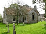
Ramridge Park
Hampshire geography stubsTest ValleyVillages in Hampshire
Ramridge Park is a hamlet in the civil parish of The Pentons in the Test Valley district of Hampshire, England. It is in the civil parish of Penton Grafton. Its nearest town is Andover, which lies approximately 3.75 miles (6 km) south-east from the hamlet.
Excerpt from the Wikipedia article Ramridge Park (License: CC BY-SA 3.0, Authors).Ramridge Park
Penton Lane, Test Valley
Geographical coordinates (GPS) Address Nearby Places Show on map
Geographical coordinates (GPS)
| Latitude | Longitude |
|---|---|
| N 51.2284486 ° | E -1.552412 ° |
Address
Penton Lane
SP11 0QD Test Valley
England, United Kingdom
Open on Google Maps


