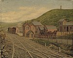
Foel Cwmcerwyn
Highest points of Welsh countiesMarilyns of WalesMountains and hills of PembrokeshirePages with Welsh IPAPembrokeshire geography stubs

Foel Cwmcerwyn is the highest point of the Preseli Hills and of Pembrokeshire. It lies within the borders of the Pembrokeshire Coast National Park although it is 10 km from the sea. A path leads to the summit from the village of Rosebush in the south-west. A trig point and a number of cairns are dotted across the summit area, and there is a disused quarry on the hill's western slopes.
Excerpt from the Wikipedia article Foel Cwmcerwyn (License: CC BY-SA 3.0, Authors, Images).Foel Cwmcerwyn
Geographical coordinates (GPS) Address Nearby Places Show on map
Geographical coordinates (GPS)
| Latitude | Longitude |
|---|---|
| N 51.94566 ° | E -4.77461 ° |
Address
Maenclochog
, Maenclochog
Wales, United Kingdom
Open on Google Maps


