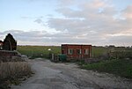
River Rother, East Sussex

The River Rother flows for 35 miles (56 km) through the English counties of East Sussex and Kent. Its source is near Rotherfield in East Sussex, and its mouth is on Rye Bay, part of the English Channel. Prior to 1287, its mouth was further to the east at New Romney, but it changed its course after a great storm blocked its exit to the sea. It was known as the Limen until the sixteenth century. For the final 14 miles (23 km), the river bed is below the high tide level, and Scots Float sluice is used to control levels. It prevents salt water entering the river system at high tides, and retains water in the river during the summer months to ensure the health of the surrounding marsh habitat. Below the sluice, the river is tidal for 3.7 miles (6.0 km). The river has been used for navigation since Roman times, and is still navigable by small boats as far as Bodiam Castle. It flowed in a loop around the northern edge of the Isle of Oxney until 1635, when it was diverted along the southern edge. Scots Float Sluice was built before 1723, when the engineer John Reynolds made repairs to it, and later extended it, to try to keep the channel clear of silting, but it was criticised by John Rennie in 1804, as it was inconvenient to shipping. The river became part of a defensive line to protect England from the threat of invasion by the French in the early 1800s, when its lower section and part of the River Brede formed a link between the two halves of the Royal Military Canal. Scots Float Sluice was again rebuilt in 1844. Some 31 square miles (80 km2) of the valley were inundated by floodwater in 1960, which resulted in the Rother Area Drainage Improvement Scheme being implemented between 1966 and 1980. The river banks were raised, and 20 pumping stations were installed. The river has been managed by a number of bodies, including the Rother Levels Commissioners of Sewers, the Rye Harbour Commissioners, and the Board of Conservators for the River Rother. After the passing of the Land Drainage Act 1930, it was managed by the Rother and Jury's Gut Catchment Board, the Kent River Board, the Kent and Sussex River Authorities, the National Rivers Authority and finally the Environment Agency. It is unusual, in that while it is under the jurisdiction of the Environment Agency, it has been a free river since 1826, and so no licence is required to use it. Management of the levels adjacent to the river is undertaken by the Romney Marshes Area Internal Drainage Board. The Rother passes by or near the villages of Etchingham, Robertsbridge, Bodiam, Northiam, and Wittersham.
Excerpt from the Wikipedia article River Rother, East Sussex (License: CC BY-SA 3.0, Authors, Images).River Rother, East Sussex
Camber Road, Rother Camber
Geographical coordinates (GPS) Address Nearby Places Show on map
Geographical coordinates (GPS)
| Latitude | Longitude |
|---|---|
| N 50.930913 ° | E 0.771844 ° |
Address
Camber Road
TN31 7QT Rother, Camber
England, United Kingdom
Open on Google Maps


