place

Albis Pass

Canton of Zürich geography stubsMountain passes of SwitzerlandMountain passes of the canton of Zürich
Albispass
Albispass

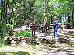
Albis Pass (el. 793 m or 2,602 ft) is a mountain pass in the Albis range in the canton of Zurich in Switzerland. It connects Langnau am Albis with the small village of Türlen on the Türlersee and, further on, Aeugst am Albis, Hausen am Albis, Mettmenstetten and Rifferswil. Other nearby passes across the same chain are Buechenegg to the north, and Schnabellücken, which is undeveloped except for a hiking trail, to the south. The eastern ramp and crest of the pass is in the municipality of Langnau, with the western ramp in Hausen.The pass is first mentioned in 1492, when the Zurich Council made a decision on road maintenance. In past times it was regarded as an important route between Zurich and central Switzerland. In 1713, Zurich military authorities are recorded as regarding transport over the Albis Pass as being simpler and cheaper than going via Birmensdorf or Horgen. However the construction of the railway from Thalwil to Zug and later roads rendered the pass less important.The road over the Albis pass is served hourly during daylight hours by a bus connecting Hausen am Albis to the train station in Thalwil. A walking trail to the north follows the ridge-line of the Albis range and leads to Buechenegg, Felsenegg and Uetliberg.

Excerpt from the Wikipedia article Albis Pass (License: CC BY-SA 3.0, Authors, Images).

Albis Pass
Albisstrasse,

Geographical coordinates (GPS) Address Nearby Places
placeShow on map

Wikipedia: Albis PassContinue reading on Wikipedia

Geographical coordinates (GPS)

Latitude Longitude
N 47.276111111111 ° E 8.5222222222222 °
placeShow on map

Address

Albisstrasse
8135
Zurich, Switzerland
mapOpen on Google Maps

Albispass
Albispass
Share experience

Nearby Places

Albis
Albis

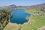
The Albis is a chain of hills in the Canton of Zürich, Switzerland, stretching for some 19 km from Sihlbrugg in the south to Waldegg near Zürich in the north. The chain forms, among others, the border between the Affoltern and Horgen districts. The best known point is Uetliberg at 870 m, overlooking the city of Zürich. Other points of interest include the Albishorn (909m.) the Bürglen (also known as Bürglenstutz, the highest peak, 914.6m.), the Schnabelburg, an observation tower, the Albis Pass, the small town of Buechenegg, and the extensive woods (known as the Sihlwald forest) on both sides of the river Sihl. The Sihl Valley borders the Albis chain on its entire east side. On the west side, the Albis is bordered by various streams (including the Reppisch) and one lake, the Türlersee. The chain is mostly wooded, but also has extensive fields, often reaching to the summit, some cultivated, some used as pastures for cows or sheep. Being very near Zürich, the area is heavily visited, especially near its northern end, and includes many restaurants along the summit (from Uetliberg to Albishorn), well-maintained trails and dirt roads, a railroad (the Uetlibergbahn) from Zürich, and a cable car (Felseneggbahn) from Adliswil to Felsenegg. The Albis chain was formed as the left moraine of the glacier the bed of which is now Lake Zürich. The soil is mostly a conglomerate of gravel, some of it large, and glacial loess. The frequently steep sides of the chain are often subject to small landslides. As a generalization, the eastern side of the chain (overlooking Lake Zürich) tends to be steeper than the western side. The hilltops of the Albis provided several good defensive sites, and were the locations of the castles of Uetliberg, Baldern and Schnabelburg, all of which are now ruined or lost.