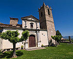
Plain of Vic

The Plain of Vic (Catalan Plana de Vic) is a 30 km long depression located at the eastern end of the Catalan Central Depression in the Osona comarca. It is named after the town of Vic, an important and ancient urban center in this natural region that lies in the midst of the plain. Other significant towns in the plain are Manlleu and Tona. This natural depression carved by river Ter and its tributaries is longer than it is wide and stretches in a N / S direction. It is completely surrounded by mountains: The Sub-Pyrenees, with Bellmunt mountain towering in the north, the Lluçanès (Pre-Pyrenees) and Moianès high plateau in the West, the Montseny in the southeast and the Guilleries, located at the apex of the Catalan Transversal Range and the Pre-Coastal Range, in the east.
Excerpt from the Wikipedia article Plain of Vic (License: CC BY-SA 3.0, Authors, Images).Plain of Vic
Carrer de Sant Fidel,
Geographical coordinates (GPS) Address Nearby Places Show on map
Geographical coordinates (GPS)
| Latitude | Longitude |
|---|---|
| N 41.931111111111 ° | E 2.2558333333333 ° |
Address
Banco Santander
Carrer de Sant Fidel
08500
Catalonia, Spain
Open on Google Maps


