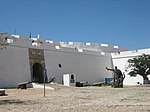
Ilha de Luanda
Landforms of AngolaLuandaMunicipalities in LuandaPeninsulas of AfricaSpits (landform)

Ilha do Cabo (English: Cape Island) typically known as Ilha de Luanda (English: Island of Luanda) is a spit off the shore of Luanda, the capital of Angola, a country on the continents' southwestern coast. It consists of a low sandy strip formed by sedimentation. In administrative terms, the peninsula belongs to the municipality of Ingombota in the Luanda Province.
Excerpt from the Wikipedia article Ilha de Luanda (License: CC BY-SA 3.0, Authors, Images).Ilha de Luanda
Luanda
Geographical coordinates (GPS) Address Nearby Places Show on map
Geographical coordinates (GPS)
| Latitude | Longitude |
|---|---|
| N -8.7786111111111 ° | E 13.243611111111 ° |
Address
Luanda (Salga)
Luanda Province, Angola
Open on Google Maps


