place

Gabii

Archaeological sites in LazioCatholic titular sees in EuropeCities and towns in LazioFormer populated places in ItalyLatin cities
Monte CompatriRoman sites in LazioRoman towns and cities in Italy
Gabii 0937
Gabii 0937

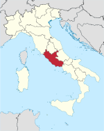
Gabii was an ancient city of Latium, located 18 km (11 mi) due east of Rome along the Via Praenestina, which was in early times known as the Via Gabina. It was on the south-eastern perimeter of an extinct volcanic crater lake, approximately circular in shape, named the Lacus Gabinus, and then during later times called the Lago di Castiglione, "lake of the fortification", after Castiglione, a mediaeval tower erected on the site of the ancient acropolis, or arx, of Gabii. A necropolis is adjacent on that side of the lake. At present, the former lake is entirely agricultural land. The ruins of the ancient city project from the fields next to the cliffs overlooking it, on both sides of the via. A municipium in Roman times, Gabii is currently located in the frazione of Osteria dell'Osa 10 km (6.2 mi) from the comune of Monte Compatri, of which it is a part, in the Province of Rome, Region of Lazio. The site is under new seasonal archaeological excavation.

Excerpt from the Wikipedia article Gabii (License: CC BY-SA 3.0, Authors, Images).

Gabii
Via Prenestina Nuova, Rome Municipio Roma VI

Geographical coordinates (GPS) Address Website Nearby Places
placeShow on map

Wikipedia: GabiiContinue reading on Wikipedia

Geographical coordinates (GPS)

Latitude Longitude
N 41.886944444444 ° E 12.715833333333 °
placeShow on map

Address

Sito archeologico di Gabii

Via Prenestina Nuova
00077 Rome, Municipio Roma VI
Lazio, Italy
mapOpen on Google Maps

Website
archeoroma.beniculturali.it

linkVisit website

Gabii 0937
Gabii 0937
Share experience

Nearby Places

Collatia
Collatia

Collatia was an ancient town of central Italy, c. 15 km northeast of Rome by the Via Collatina.It appears in the legendary history of Rome as captured by Tarquinius Priscus. Vergil speaks of it as a Latin colony of Alba Longa. In the time of Cicero it had lost all importance; Strabo names it as a mere village, in private hands, while for Pliny it was one of the lost cities of Latium.According to Livy, it was taken, along with its population and surrounding land, from the Sabines by Tarquinius Priscus at the conclusion of his war against them. Livy records the wording of the form of the town's surrender. The date of Tarquinius' triumph over the Sabines, according to the Fasti Triumphales, which Livy says occurred shortly after the surrender of Collatia, is 13 September, 585 BC. By 509 BC the town was governed by the Roman Lucius Tarquinius Collatinus, who took his name from the town. It was the site of the rape of Lucretia in that year, and Livy records that the leaders of the revolution which followed thereafter, gathered in Collatia to hear Lucretia's tale, then gathered the youth of Collatia to commence their revolution.The site is undoubtedly to be sought on the hill now occupied by the large medieval fortified farmhouse of Castello di Lunghezza immediately to the south of the Anio, which occupies the site of the citadel joined by a narrow neck to the tableland to the southeast on which the city stood: this is protected by wide valleys on each side, and is isolated at the southeast end by a deep narrow valley enlarged by cutting.No remains are to be seen, but the site is admirably adapted for an ancient settlement. The road may be traced leading to the south end of this tableland, being identical with the modern road to Lunghezza for the middle part of its course only. The earlier identification with Castellaccio, c. 3.5 km to the southeast, is untenable.