Elmhurst, Queens

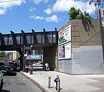
Elmhurst (formerly Newtown) is a neighborhood in the borough of Queens in New York City. It is bounded by Roosevelt Avenue on the north; the Long Island Expressway on the south; Junction Boulevard on the east; and the New York Connecting Railroad on the west.The village, originally named Middleburgh, was established in 1652 by English Puritans, approximately 7 miles from New Amsterdam. When the British took over New Netherland in 1664, they renamed it New Town, which was eventually simplified to Newtown. It remained a rural community until the late 1890s, when it was renamed Elmhurst and became part of the City of Greater New York. Elmhurst became heavily developed with residential and commercial structures in the early 20th century, and many immigrants started moving in during the latter part of the century. Elmhurst is located in Queens Community District 4 and its ZIP Code is 11373. It is patrolled by the New York City Police Department's 110th Precinct. Politically, Elmhurst is represented by the New York City Council's 25th District and small parts of the 21st, 24th, and 29th Districts.
Excerpt from the Wikipedia article Elmhurst, Queens (License: CC BY-SA 3.0, Authors, Images).Elmhurst, Queens
Dongan Avenue, New York Queens
Geographical coordinates (GPS) Address Nearby Places Show on map
Geographical coordinates (GPS)
| Latitude | Longitude |
|---|---|
| N 40.74 ° | E -73.88 ° |
Address
Dongan Avenue 83-24
11373 New York, Queens
New York, United States
Open on Google Maps


