St Harmon

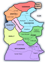
St Harmon (Welsh: Llanarmon) is a village in Radnorshire, Powys, Wales. The population of the Community at the 2011 census was 593. It is located on the Afon Marteg on the B4518 road running between Llanidloes and Rhayader. The parish church is called Saint Garmon (Germanus of Auxerre), with many people assuming it has been spelt incorrectly. In fact, the village name of St Harmon is a further Anglicisation of the name St Garmon. St Garmon's Church is known for having the diarist the Reverend Francis Kilvert serve as Vicar there between 1876 and 1877. It did have its own railway station- St Harmons railway station. The community includes the settlement of Pantydwr and Nantgwyn. St Harmon FC is the village football team. The Sun Inn was the village pub but has now been converted to a home.
Excerpt from the Wikipedia article St Harmon (License: CC BY-SA 3.0, Authors, Images).St Harmon
B4518,
Geographical coordinates (GPS) Address Nearby Places Show on map
Geographical coordinates (GPS)
| Latitude | Longitude |
|---|---|
| N 52.344 ° | E -3.4861 ° |
Address
B4518
LD6 5LU , St. Harmon
Wales, United Kingdom
Open on Google Maps


