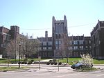
Meriwether, Louisville
1871 establishments in KentuckyJefferson County, Kentucky geography stubsLouisville, Kentucky stubsNeighborhoods in Louisville, KentuckyPopulated places established in 1871

Meriwether is a neighborhood two miles southeast of downtown Louisville, Kentucky, USA, and just east of the University of Louisville. It was laid out by David Meriwether in 1871 and the first houses were built in 1891. Nearly all of the homes are shotgun houses. Its boundaries are the CSX railroad tracks to the north, Shelby Street to the east and I-65 to the west. Lincoln Park and Preston Park are located in the neighborhood. It is commonly referred to as part of greater Schnitzelburg. Meriwether is also sometimes confused with Louisville's Germantown and Saint Joseph's neighborhood.
Excerpt from the Wikipedia article Meriwether, Louisville (License: CC BY-SA 3.0, Authors, Images).Meriwether, Louisville
East Hill Street, Louisville
Geographical coordinates (GPS) Address Nearby Places Show on map
Geographical coordinates (GPS)
| Latitude | Longitude |
|---|---|
| N 38.224166666667 ° | E -85.745833333333 ° |
Address
East Hill Street 626
40217 Louisville
Kentucky, United States
Open on Google Maps


