Étale (mountain)
Haute-Savoie geography stubsMountains of Haute-SavoieMountains of SavoieMountains of the AlpsSavoie geography stubs

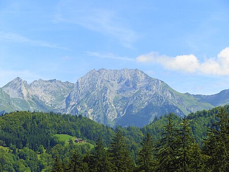
Étale is a mountain of Savoie and Haute-Savoie, France. It lies in the Aravis Range of the French Prealps and has an elevation of 2,484 metres above sea level.
Excerpt from the Wikipedia article Étale (mountain) (License: CC BY-SA 3.0, Authors, Images).Étale (mountain)
Annecy
Geographical coordinates (GPS) Address Nearby Places Show on map
Geographical coordinates (GPS)
| Latitude | Longitude |
|---|---|
| N 45.85 ° | E 6.4475 ° |
Address
Couloir Combaz
74230 Annecy
Auvergne-Rhône-Alpes, France
Open on Google Maps


