Mont Revard
Mountains of SavoieMountains of the AlpsPages with French IPA

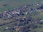
Mont Revard (French pronunciation: [mɔ̃ ʁəvaʁ], 1,562 m (5,125 ft)) is a mountain in the Bauges Massif near Aix-les-Bains in Savoie, France. The mountain is crossed by the D913 road between the villages of Saint-Jean-d'Arvey and Pugny-Chatenod near Aix-les-Bains. The ski resort of Le Revard is situated on the northern edge of the mountain at an elevation of 1,537 m (5,043 ft).The summit on the D913 is at an elevation of 1,463 m (4,800 ft) and was crossed on the penultimate stage of the 2013 Tour de France (Stage 20). The Tour de France had crossed the pass twice previously and has had a stage finish twice on the summit.
Excerpt from the Wikipedia article Mont Revard (License: CC BY-SA 3.0, Authors, Images).Mont Revard
Route du Revard, Chambéry
Geographical coordinates (GPS) Address Nearby Places Show on map
Geographical coordinates (GPS)
| Latitude | Longitude |
|---|---|
| N 45.681944444444 ° | E 5.9755555555556 ° |
Address
Route du Revard
73230 Chambéry
Auvergne-Rhône-Alpes, France
Open on Google Maps


