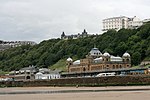
Knipe Point
Borough of ScarboroughHeadlands of North YorkshireLandslides in 2008Landslides in the United KingdomPopulated coastal places in North Yorkshire ... and 1 more
Villages in North Yorkshire

Knipe Point (or Osgodby Point) is a rocky headland on the North Sea coast, between Cornelian Bay and Cayton Bay in North Yorkshire, England. From this point, and running south, is the steeply sloping clay-till cliff on top of which stood the NALGO holiday camp between 1933 and 1974; this is where Knipe Point Drive was later built. The Cayton Cliff is subject to continuing surface landslips, potentially major at times, such as the one of 2008, known as the Knipe Point Landslide, which received national media attention due to the loss of three homes.
Excerpt from the Wikipedia article Knipe Point (License: CC BY-SA 3.0, Authors, Images).Knipe Point
Savile's View,
Geographical coordinates (GPS) Address Nearby Places Show on map
Geographical coordinates (GPS)
| Latitude | Longitude |
|---|---|
| N 54.253 ° | E -0.367 ° |
Address
War time coastal defences
Savile's View
YO11 3NP , Osgodby
England, United Kingdom
Open on Google Maps


