Hamstead Colliery
1876 establishments in EnglandCoal mines in EnglandGeographic coordinate listsHistory of the West Midlands (county)Lists of coordinates ... and 1 more
West Bromwich

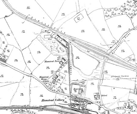
Hamstead Colliery in Hamstead (then Staffordshire, now West Midlands), England, produced coal between 1878 and 1965, by mining the South Staffordshire 'Thick' coal seam. It suffered a major fire in 1908 in which 26 men died.
Excerpt from the Wikipedia article Hamstead Colliery (License: CC BY-SA 3.0, Authors, Images).Hamstead Colliery
Greenway, Birmingham Hamstead
Geographical coordinates (GPS) Address Nearby Places Show on map
Geographical coordinates (GPS)
| Latitude | Longitude |
|---|---|
| N 52.53188 ° | E -1.93336 ° |
Address
Greenway
Greenway
B20 1EQ Birmingham, Hamstead
England, United Kingdom
Open on Google Maps


