Hamstead, West Midlands

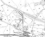
Hamstead is an area straddling the border of Birmingham and Sandwell, England, between Handsworth Wood and Great Barr, and adjacent to the Sandwell Valley area of West Bromwich. Hamstead Colliery was worked from the 19th century to the 1960s, with much housing built for the miners. Today the area is still referred to as Hamstead Village. The River Tame enters Hamstead after passing through Sandwell Valley, and runs through the village before exiting into Perry Hall Park. It is the largest tributary of the River Trent but is not navigable. After heavy rains it can overspill its banks, flooding the village. As of 2020, flood alleviation works are being undertaken at Sandwell Valley, to protect Hamstead. Two brick bridges over the Tame in Hamstead are Grade II listed. St Paul's Church, Hamstead was consecrated in 1892. Its grounds include Hamstead War Memorial, commemorating local men who died in World War I. Both church and memorial are Grade II listed. There is also a secondary School, Hamstead Hall Academy.
Excerpt from the Wikipedia article Hamstead, West Midlands (License: CC BY-SA 3.0, Authors, Images).Hamstead, West Midlands
Montana Avenue, Birmingham Hamstead
Geographical coordinates (GPS) Address Nearby Places Show on map
Geographical coordinates (GPS)
| Latitude | Longitude |
|---|---|
| N 52.53057 ° | E -1.924748 ° |
Address
Montana Avenue 40
B42 1QP Birmingham, Hamstead
England, United Kingdom
Open on Google Maps


