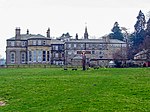
Burnhope Burn

Burnhope Burn is a Site of Special Scientific Interest in the Wear Valley district of north County Durham, England. It consists of a 12.6-acre (5.1 ha) area of woodland, carr, fen and mire in the valley of Burnhope Burn, just below the dam of the Derwent Reservoir, a mile (1.6 km) north-east of the village of Edmundbyers. It contains a range of habitats that are characteristic of poorly drained soils and that are rare or local in County Durham; such as smooth-stalked sedge (Carex levigata), bogbean (Menyanthes) and globeflower (Trollius). In a small basin-mire in the northern part of the site, there are abundant communities of a number of species that have a localised distribution elsewhere in the county.
Excerpt from the Wikipedia article Burnhope Burn (License: CC BY-SA 3.0, Authors, Images).Burnhope Burn
B6278,
Geographical coordinates (GPS) Address Nearby Places Show on map
Geographical coordinates (GPS)
| Latitude | Longitude |
|---|---|
| N 54.851666666667 ° | E -1.9555555555556 ° |
Address
B6278
DH8 9TT , Edmondbyers
England, United Kingdom
Open on Google Maps


