Meadvale
EngvarB from June 2016Hamlets in SurreyReigate and Banstead

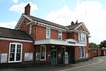
Meadvale or less commonly Mead Vale is a southern residential suburb that straddles borders of Redhill and Reigate in the borough of Reigate and Banstead in Surrey, and one of two which do so. The average elevation of the district is higher than the centres of each of the towns – Meadvale is bisected east-west by the Greensand Way at the top of a moderately low section of the Greensand Ridge. Its population, as broadly defined on its ward definition, is 3,090 spread over 64 hectares (160 acres) based upon the most recent national census.
Excerpt from the Wikipedia article Meadvale (License: CC BY-SA 3.0, Authors, Images).Meadvale
Somerset Road, Reigate and Banstead Meadvale
Geographical coordinates (GPS) Address Nearby Places Show on map
Geographical coordinates (GPS)
| Latitude | Longitude |
|---|---|
| N 51.22721 ° | E -0.18707 ° |
Address
Somerset Road
Somerset Road
RH1 6LT Reigate and Banstead, Meadvale
England, United Kingdom
Open on Google Maps


