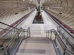
Drumul Taberei

Drumul Taberei (Romanian: [ˈdru.mul ˈta.be.rej], The Camp Road) is a neighbourhood located in the south-west of Bucharest, Romania, roughly between Timișoara Avenue (south of Plaza România and the Cotroceni Railway Station) and Ghencea Avenue, neighboring Militari to the north, Panduri to the east and Ghencea and Rahova to the south and south-east. It is one of the few examples of successful urban planning during Communist Romania, despite it being built in the Eastern European tradition of "dormitory neighborhoods". This success is mostly due to the unique approach of the architects and planners to the concept of high-density urban living, an approach that was not used elsewhere in Bucharest.
Excerpt from the Wikipedia article Drumul Taberei (License: CC BY-SA 3.0, Authors, Images).Drumul Taberei
Strada Pașcani, Bucharest Drumul Taberei
Geographical coordinates (GPS) Address Nearby Places Show on map
Geographical coordinates (GPS)
| Latitude | Longitude |
|---|---|
| N 44.42005 ° | E 26.024536111111 ° |
Address
Strada Pașcani 6
062084 Bucharest, Drumul Taberei
Romania
Open on Google Maps


