place

Jones Bridge

Bridges in ManilaBuildings and structures in BinondoBuildings and structures in ErmitaJuan M. Arellano buildingsNeoclassical architecture in the Philippines
Use Philippine English from January 2023Use mdy dates from January 2023
Jones Bridge sunset (Binondo, Manila; 02 04 2021)

The William A. Jones Memorial Bridge, commonly known as the Jones Bridge, is an arched girder bridge that spans the Pasig River in the City of Manila, Philippines. It is named after the United States legislator William Atkinson Jones, who served as the chairman of the U.S. Insular Affairs House Committee which had previously exercised jurisdiction over the Philippines and the principal author of the Jones Law that gave the country legislative autonomy from the United States. Built to replace the historic Puente de España (Bridge of Spain) in the 1910s, the bridge connects Quintin Paredes Road at the Binondo district to Padre Burgos Avenue at the Ermita district. Originally designed by Filipino architect Juan M. Arellano using French Neoclassical architecture, the first incarnation of the bridge features three arches resting on two heavy piers, adorned by faux-stone and concrete ornaments, as well as four sculptures on concrete plinths allegorically representing motherhood and nationhood. The original bridge was destroyed during the World War II by retreating Japanese troops and was reconstructed in 1946 by the U.S. and Philippine public works. The reconstructed bridge retained the three arches and two piers but removed all of the ornaments. The bridge was first partially restored in 1998. In 2019, the City Government of Manila began a rehabilitation project to "restore" the Jones Bridge to its near-original design using Beaux-Arts architecture similar to that of Pont Alexandre III in Paris and the return of all four La Madre Filipina sculptures.

Excerpt from the Wikipedia article Jones Bridge (License: CC BY-SA 3.0, Authors, Images).

Jones Bridge
Jones Bridge, Manila

Geographical coordinates (GPS) Address Nearby Places
placeShow on map

Wikipedia: Jones BridgeContinue reading on Wikipedia

Geographical coordinates (GPS)

Latitude Longitude
N 14.595833333333 ° E 120.97730555556 °
placeShow on map

Address

Jones Bridge

Jones Bridge
1006 Manila (Fifth District)
Philippines
mapOpen on Google Maps

Jones Bridge sunset (Binondo, Manila; 02 04 2021)
Share experience

Nearby Places

Manila
Manila

Manila ( mə-NIL-ə, Spanish: [maˈnila]; Filipino: Maynila, pronounced [majˈnilaʔ]), officially City of Manila (Filipino: Lungsod ng Maynila, [luŋˈsod nɐŋ majˈnilaʔ]), is the capital of the Philippines and its second-most populous city. Manila is located on the eastern shore of Manila Bay on the island of Luzon. It is highly urbanized and as of 2019, was the world's most densely populated city proper. Manila is considered to be a global city and is rated as an Alpha – City by Globalization and World Cities Research Network (GaWC). It was the first chartered city in the country, and was designated as such by the Philippine Commission Act 183 of July 31, 1901. It became autonomous with the passage of Republic Act No. 409, "The Revised Charter of the City of Manila", on June 18, 1949. Manila is considered to be part of the world's original set of global cities because its commercial networks were the first to extend across the Pacific Ocean and connect Asia with the Spanish Americas through the galleon trade; when this was accomplished, it was the first time an uninterrupted chain of trade routes circling the planet had been established. Manila is among the most-populous and fastest-growing cities in Southeast Asia.By 1258, a Tagalog-fortified polity called Maynila existed on the site of modern Manila. On June 24, 1571, after the defeat of the polity's last indigenous Rajah Sulayman III in the Battle of Bangkusay, Spanish conquistador Miguel López de Legazpi began constructing the walled fortification Intramuros on the ruins of an older settlement from whose name the Spanish-and-English name Manila derives. Manila was used as the capital of the captaincy general of the Spanish East Indies, which included the Marianas, Guam and other islands, and was controlled and administered for the Spanish crown by Mexico City in the Viceroyalty of New Spain. Today, Manila has many historic sites. In modern times, the name "Manila" is commonly used to refer to the whole metropolitan area, the greater metropolitan area, and the city proper. Metro Manila, the officially defined metropolitan area, is the capital region of the Philippines, and includes the much-larger Quezon City and Makati Central Business District. It is the most-populous region in the country, one of the most-populous urban areas in the world, and one of the wealthiest regions in Southeast Asia. The city proper was home to 1,846,513 people in 2020,  and is the historic core of a built-up area that extends well beyond its administrative limits. With 71,263 people per square kilometer, Manila is the most densely populated city proper in the world. The Pasig River flows through the middle of the city, dividing it into north and south sections. The city comprises 16 administrative districts and is divided into six political districts for the purposes of representation in the Congress of the Philippines and the election of city council members. In 2018, the Globalization and World Cities Research Network listed Manila as an "Alpha-" global city, and ranked it seventh in economic performance globally and second regionally, while the Global Financial Centres Index ranks Manila 79th in the world. Manila is also the world's second-most natural disaster exposed city, yet is also among the fastest developing cities in Southeast Asia, and also the most loving capital city in the world.

El Hogar Filipino Building

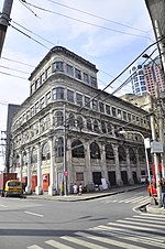
El Hogar Filipino Building, also known simply as El Hogar, is an early skyscraper in Manila, Philippines. Built in 1914 and located at the corner of Juan Luna Street and Muelle dela Industría in the Binondo district, El Hogar Building was designed by Ramon Irureta-Goyena and Francisco Perez-Muñoz in the Beaux-Arts style. Its architecture reflects elements of Neoclassical and Renaissance styles. El Hogar Building was built as a wedding present of Antonio Melian y Pavia, third Count of Peracamps, to his bride Margarita Zóbel de Ayala, who was a sister of Enrique Zóbel de Ayala in 1914. During its heyday, El Hogar Building housed the Sociedad El Hogar Filipino, a financing cooperative founded by Melian, and the offices of Smith Bell and CompanyIt survived World War II and a number of earthquakes and is one of two remaining American-era structures in the area facing the Pasig River. Right across Juan Luna Street, on its northern front, is another important edifice, the Pacific Commercial Company Building or commonly known as the First National City Bank Building which was built in 1922. The value of the building is its architecture, which is a representation of American period design, materials, and construction method. El Hogar Building is a representation of the architecture of business establishments of that era. It also has a collective value as one of the significant structures within the historic Binondo district and Escolta Street, along the cultural landscape of the Pasig River.