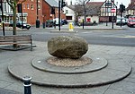
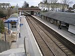
Royston, Hertfordshire
Civil parishes in HertfordshireRoyston, HertfordshireTowns in HertfordshireUse British English from February 2013

Royston is a town and civil parish in the District of North Hertfordshire and county of Hertfordshire in England. It is situated on the Greenwich Meridian, which brushes the town's eastern boundary, and at the northernmost apex of the county on the same latitude as towns such as Milton Keynes and Ipswich. It is about 43 miles (69 km) north of central London in a rural area. Before the boundary changes of the 1890s, the boundary between Hertfordshire and Cambridgeshire ran east–west through the centre of town along the middle of Melbourn Street. The town has a population of 17,448 as of 2021.
Excerpt from the Wikipedia article Royston, Hertfordshire (License: CC BY-SA 3.0, Authors, Images).Royston, Hertfordshire
Sörnziger Weg, Verwaltungsgemeinschaft Rochlitz
Geographical coordinates (GPS) Address Website Nearby Places Show on map
Geographical coordinates (GPS)
| Latitude | Longitude |
|---|---|
| N 52.0471 ° | E -0.0202 ° |
Address
Schloss Rochlitz
Sörnziger Weg 1
09306 Verwaltungsgemeinschaft Rochlitz, Rochlitz
Sachsen, Deutschland
Open on Google Maps


