place

Curtis Lake (Clark County, Washington)

Lakes of Clark County, WashingtonLakes of Washington (state)

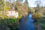
Curtis Lake is a lake in Clark County in the U.S. state of Washington. The lake, near the confluence of Salmon Creek and Lake River, is northwest of the community of Felida.The lake is home to two nonindigenous aquatic species; Perca flavescens (yellow perch) and Pomoxis annularis (white crappie).

Excerpt from the Wikipedia article Curtis Lake (Clark County, Washington) (License: CC BY-SA 3.0, Authors).

Curtis Lake (Clark County, Washington)
Northwest 57th Avenue,

Geographical coordinates (GPS) Address Nearby Places
placeShow on map

Wikipedia: Curtis Lake (Clark County, Washington)Continue reading on Wikipedia

Geographical coordinates (GPS)

Latitude Longitude
N 45.729166666667 ° E -122.73861111111 °
placeShow on map

Address

Robert L. Delanoy Airport

Northwest 57th Avenue
98685 , Felida
Washington, United States
mapOpen on Google Maps

Share experience

Nearby Places

Arndt Prune Dryer
Arndt Prune Dryer

The Arndt Prune Dryer is a specialized agricultural building in Ridgefield, Washington. Built about 1898, it is one of the last traditional farm-built prune dryer buildings in Washington, using a wood fire and natural draft to dry locally grown fruit. Prunes were a major crop in the Vancouver region, as the dried fruit could be shipped economically to markets without refrigeration or spoilage.The prune dryer is a one-story wood-frame building, originally about 14 feet (4.3 m) by 15 feet (4.6 m), built for William Arndt by a carpenter. It was expanded to its present size of 230 feet (70 m) by 40 feet (12 m) in 1920 by Fred Arndt. The structure is gabled on its narrow ends, with a shed roofed extension to the rear and a similar extension on the front with a partial porch. The walls are clad with vertical wood siding. A small shed extension is attached to the rear gable. The shake roof is crowned by a tall, narrow wood ventilator with a gabled cap that runs perpendicular to the main roof ridgeline. The whole structure rests on squared stone piers, raising it above the slope of the hillside to allow access to the furnace for stoking. The original site-built furnace was replaced in 1954 by a cast iron "Hercules" furnace taken from another prune dryer. Another stove is located outside to heat water for prune processing. The Arndt Prune Dryer was placed on the National Register of Historic Places on October 4, 1979. The surrounding lands still have mature prune trees, some planted in the 1890s.

Sauvie Island
Sauvie Island

Sauvie Island, in the U.S. state of Oregon, originally Wapato Island or Wappatoo Island, is the largest island along the Columbia River, at 26,000 acres (10,522 ha), and one of the largest river islands in the United States. It lies approximately ten miles northwest of downtown Portland, between the Columbia River to the east, the Multnomah Channel to the west, and the Willamette River to the south. A large portion of the island is designated as the Sauvie Island Wildlife Area. Sturgeon Lake, in the north central part of the island, is the most prominent water feature. The land area is 32.75 square miles (84.8 km2), or 20,959 acres (8,482 ha). Most of the island is in Multnomah County, but the northern third is in Columbia County. The Wapato Bridge provides access across the Multnomah Channel from U.S. Route 30 and was completed in June 2008, replacing the first bridge to connect the island to the mainland which was opened on December 30, 1950. The island received the name "Sauvés Island" after Laurent Sauvé dit Laplante, a French-Canadian who managed a dairy for the Hudson's Bay Company in the 1830s and 1840s. It is predominantly farmland and wildlife refuge and is a popular place for picking pumpkins, hunting geese and kayaking. There were 1,078 year-round residents at the 2000 census. There is an industrial zone and small grocery store in the southeast corner, near the bridge. Bicyclists flock to the island because its flat topography and lengthy low-volume roads make it ideal for cycling. Its nearest incorporated neighbors are the Portland-Vancouver metropolitan area to its south and southeast; St. Helens across the Multnomah Channel from the extreme northern tip of the island; and Scappoose, across the Multnomah Channel to the west.