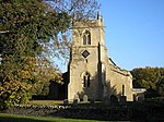
Melchbourne
Bedfordshire geography stubsBorough of BedfordFormer civil parishes in BedfordshireVillages in Bedfordshire

Melchbourne is a village and former civil parish, now in the parish of Melchbourne and Yielden, in the Bedford district, in the ceremonial county of Bedfordshire, England. In 1931 the parish had a population of 160. On 1 April 1934 the parish was abolished to form "Melchbourne and Yelden".The village is located west of Swineshead and east of Yelden. Melchbourne Preceptory was located in the village. Today the village is the location of the Church of St Mary Magdalene.
Excerpt from the Wikipedia article Melchbourne (License: CC BY-SA 3.0, Authors, Images).Melchbourne
Knotting Road,
Geographical coordinates (GPS) Address Nearby Places Show on map
Geographical coordinates (GPS)
| Latitude | Longitude |
|---|---|
| N 52.28055 ° | E -0.49353 ° |
Address
Knotting Road
Knotting Road
MK44 1BE , Melchbourne and Yielden
England, United Kingdom
Open on Google Maps


