N5 road (Belgium)

The N5 is a road in Belgium connecting the small ring in Brussels and Philippeville via Charleroi (commonly named French: Route de Philippeville till the ring of Charleroi). This road could be one of the deadliest of the country. This is not only due to the traffic density and the old fashioned road safety features, but also because many country roads are joining onto a high speed lane, namely the tractors harvesting sugar beet. It has also been part of the history of Belgium in the Battle of Waterloo, during which the Imperial French Army went through this path to join the battlefield of Quatre-Bras/LignyThe N5 crosses or borders 17 municipalities in total. 4 municipalities are located in the Brussels Capital Region, 1 in Flemish Brabant, 5 in Walloon Brabant, 4 in Hainaut and 3 in Namur. Full municipality list below, main municipalities are in bold.
Excerpt from the Wikipedia article N5 road (Belgium) (License: CC BY-SA 3.0, Authors, Images).N5 road (Belgium)
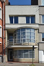
Avenue de Philippeville, Charleroi
Geographical coordinates (GPS) Address Nearby Places Show on map
Geographical coordinates (GPS)
| Latitude | Longitude |
|---|---|
| N 50.40023 ° | E 4.45276 ° |
Address
Avenue de Philippeville 119
6001 Charleroi (Marcinelle)
Hainaut, Belgium
Open on Google Maps


